You are here: Home > Network List > TA - USArray Transportable Network (new EarthScope stations) Stations List
> Station L02D Cave Junction, OR, USA > Earthquake Result Viewer
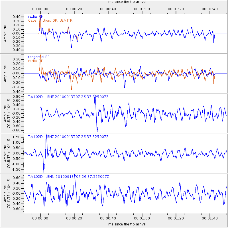
L02D Cave Junction, OR, USA - Earthquake Result Viewer
*The percent match for this event was below the threshold and hence no stack was calculated.
| Earthquake location: |
Central Peru |
| Earthquake latitude/longitude: |
-14.6/-70.8 |
| Earthquake time(UTC): |
2010/09/13 (256) 07:15:49 GMT |
| Earthquake Depth: |
180 km |
| Earthquake Magnitude: |
5.6 MB, 5.9 MW, 5.8 MW |
| Earthquake Catalog/Contributor: |
WHDF/NEIC |
|
| Network: |
TA USArray Transportable Network (new EarthScope stations) |
| Station: |
L02D Cave Junction, OR, USA |
| Lat/Lon: |
42.16 N/123.60 W |
| Elevation: |
458 m |
|
| Distance: |
74.5 deg |
| Az: |
322.061 deg |
| Baz: |
126.823 deg |
| Ray Param: |
$rayparam |
*The percent match for this event was below the threshold and hence was not used in the summary stack. |
|
| Radial Match: |
58.920403 % |
| Radial Bump: |
400 |
| Transverse Match: |
61.145233 % |
| Transverse Bump: |
400 |
| SOD ConfigId: |
319893 |
| Insert Time: |
2011-01-20 09:00:37.395 +0000 |
| GWidth: |
2.5 |
| Max Bumps: |
400 |
| Tol: |
0.001 |
|
Signal To Noise
| Channel | StoN | STA | LTA |
| TA:L02D: :BHZ:20100913T07:26:37.325007Z | 7.830134 | 7.862605E-7 | 1.00414695E-7 |
| TA:L02D: :BHN:20100913T07:26:37.325007Z | 1.4745734 | 2.2040588E-7 | 1.4947095E-7 |
| TA:L02D: :BHE:20100913T07:26:37.325007Z | 3.0471506 | 4.0827157E-7 | 1.339847E-7 |
| Arrivals |
| Ps | |
| PpPs | |
| PsPs/PpSs | |


