You are here: Home > Network List > IW - Intermountain West Stations List
> Station PLID Pearl Lake, Idaho, USA > Earthquake Result Viewer
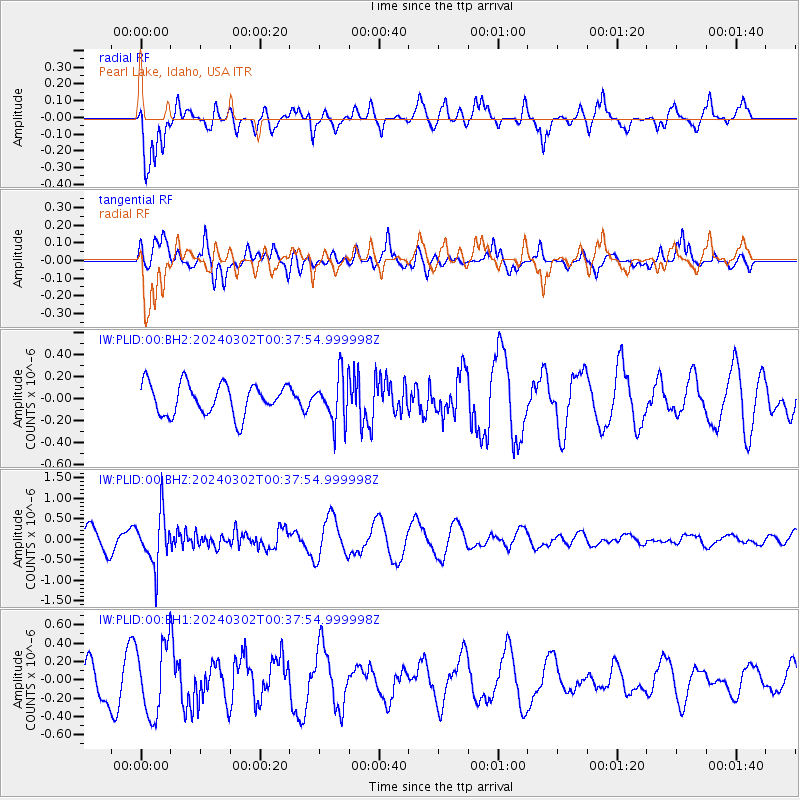
PLID Pearl Lake, Idaho, USA - Earthquake Result Viewer
*The percent match for this event was below the threshold and hence no stack was calculated.
| Earthquake location: |
Fiji Islands Region |
| Earthquake latitude/longitude: |
-20.6/-178.4 |
| Earthquake time(UTC): |
2024/03/02 (062) 00:26:40 GMT |
| Earthquake Depth: |
537 km |
| Earthquake Magnitude: |
5.8 mww |
| Earthquake Catalog/Contributor: |
NEIC PDE/us |
|
| Network: |
IW Intermountain West |
| Station: |
PLID Pearl Lake, Idaho, USA |
| Lat/Lon: |
45.09 N/116.00 W |
| Elevation: |
2164 m |
|
| Distance: |
86.5 deg |
| Az: |
38.973 deg |
| Baz: |
236.297 deg |
| Ray Param: |
$rayparam |
*The percent match for this event was below the threshold and hence was not used in the summary stack. |
|
| Radial Match: |
65.65953 % |
| Radial Bump: |
400 |
| Transverse Match: |
70.28625 % |
| Transverse Bump: |
400 |
| SOD ConfigId: |
33437571 |
| Insert Time: |
2024-03-16 00:51:59.737 +0000 |
| GWidth: |
2.5 |
| Max Bumps: |
400 |
| Tol: |
0.001 |
|
Signal To Noise
| Channel | StoN | STA | LTA |
| IW:PLID:00:BHZ:20240302T00:37:54.999998Z | 2.6061075 | 6.1945417E-7 | 2.3769324E-7 |
| IW:PLID:00:BH1:20240302T00:37:54.999998Z | 2.5280986 | 3.8667443E-7 | 1.5295069E-7 |
| IW:PLID:00:BH2:20240302T00:37:54.999998Z | 1.507394 | 2.1267941E-7 | 1.410908E-7 |
| Arrivals |
| Ps | |
| PpPs | |
| PsPs/PpSs | |


