You are here: Home > Network List > TA - USArray Transportable Network (new EarthScope stations) Stations List
> Station J01E Myrtle Point, OR, USA > Earthquake Result Viewer
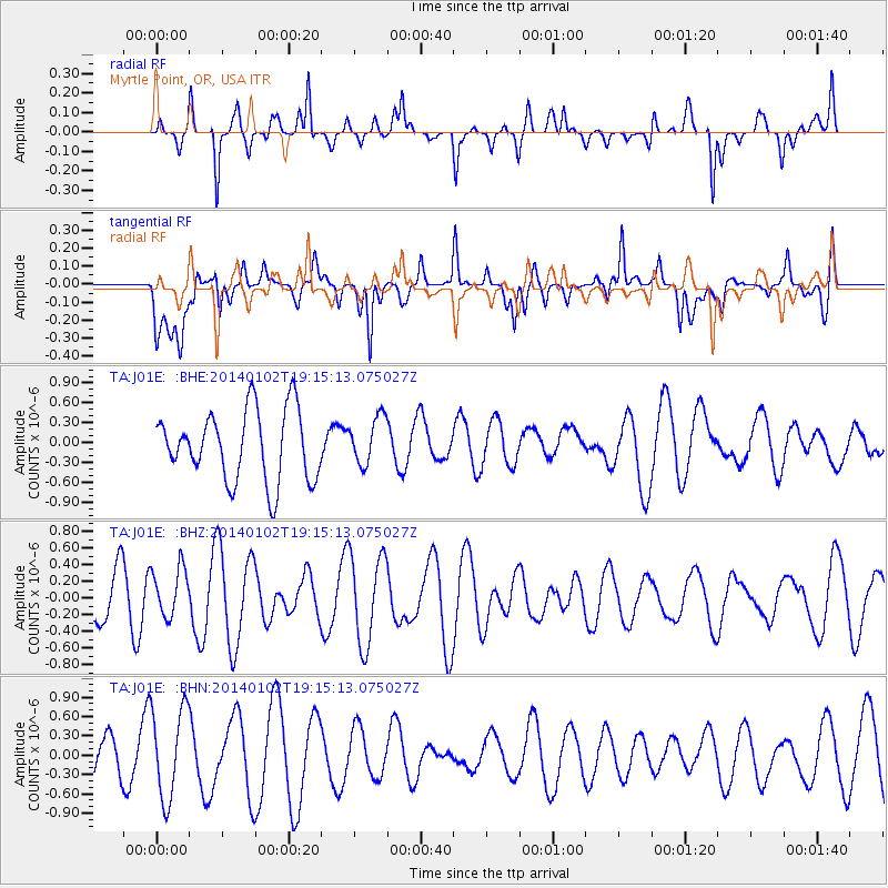
J01E Myrtle Point, OR, USA - Earthquake Result Viewer
*The percent match for this event was below the threshold and hence no stack was calculated.
| Earthquake location: |
Philippine Islands Region |
| Earthquake latitude/longitude: |
19.2/120.2 |
| Earthquake time(UTC): |
2014/01/02 (002) 19:02:26 GMT |
| Earthquake Depth: |
25 km |
| Earthquake Magnitude: |
4.8 MW |
| Earthquake Catalog/Contributor: |
ISC/ISC |
|
| Network: |
TA USArray Transportable Network (new EarthScope stations) |
| Station: |
J01E Myrtle Point, OR, USA |
| Lat/Lon: |
43.16 N/123.93 W |
| Elevation: |
128 m |
|
| Distance: |
94.5 deg |
| Az: |
41.34 deg |
| Baz: |
301.425 deg |
| Ray Param: |
$rayparam |
*The percent match for this event was below the threshold and hence was not used in the summary stack. |
|
| Radial Match: |
39.055637 % |
| Radial Bump: |
327 |
| Transverse Match: |
42.38585 % |
| Transverse Bump: |
400 |
| SOD ConfigId: |
3390531 |
| Insert Time: |
2019-04-09 20:49:01.656 +0000 |
| GWidth: |
2.5 |
| Max Bumps: |
400 |
| Tol: |
0.001 |
|
Signal To Noise
| Channel | StoN | STA | LTA |
| TA:J01E: :BHZ:20140102T19:15:13.075027Z | 0.88664764 | 2.9517204E-7 | 3.3290794E-7 |
| TA:J01E: :BHN:20140102T19:15:13.075027Z | 2.3156784 | 7.05359E-7 | 3.0460143E-7 |
| TA:J01E: :BHE:20140102T19:15:13.075027Z | 0.6779535 | 3.5993438E-7 | 5.309131E-7 |
| Arrivals |
| Ps | |
| PpPs | |
| PsPs/PpSs | |


