You are here: Home > Network List > TA - USArray Transportable Network (new EarthScope stations) Stations List
> Station D36A Goodland, MN, USA > Earthquake Result Viewer
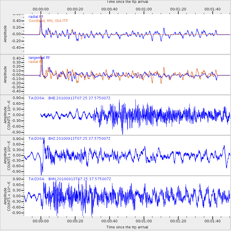
D36A Goodland, MN, USA - Earthquake Result Viewer
*The percent match for this event was below the threshold and hence no stack was calculated.
| Earthquake location: |
Central Peru |
| Earthquake latitude/longitude: |
-14.6/-70.8 |
| Earthquake time(UTC): |
2010/09/13 (256) 07:15:49 GMT |
| Earthquake Depth: |
180 km |
| Earthquake Magnitude: |
5.6 MB, 5.9 MW, 5.8 MW |
| Earthquake Catalog/Contributor: |
WHDF/NEIC |
|
| Network: |
TA USArray Transportable Network (new EarthScope stations) |
| Station: |
D36A Goodland, MN, USA |
| Lat/Lon: |
47.18 N/93.16 W |
| Elevation: |
434 m |
|
| Distance: |
64.7 deg |
| Az: |
343.298 deg |
| Baz: |
155.932 deg |
| Ray Param: |
$rayparam |
*The percent match for this event was below the threshold and hence was not used in the summary stack. |
|
| Radial Match: |
57.779884 % |
| Radial Bump: |
400 |
| Transverse Match: |
71.62435 % |
| Transverse Bump: |
400 |
| SOD ConfigId: |
319893 |
| Insert Time: |
2011-01-20 09:14:34.400 +0000 |
| GWidth: |
2.5 |
| Max Bumps: |
400 |
| Tol: |
0.001 |
|
Signal To Noise
| Channel | StoN | STA | LTA |
| TA:D36A: :BHZ:20100913T07:25:37.575007Z | 3.8022897 | 5.1158946E-7 | 1.3454773E-7 |
| TA:D36A: :BHN:20100913T07:25:37.575007Z | 2.16457 | 3.1946584E-7 | 1.4758858E-7 |
| TA:D36A: :BHE:20100913T07:25:37.575007Z | 1.7924904 | 1.9101999E-7 | 1.06566816E-7 |
| Arrivals |
| Ps | |
| PpPs | |
| PsPs/PpSs | |


