You are here: Home > Network List > US - United States National Seismic Network Stations List
> Station EGMT Eagleton, Montana, USA > Earthquake Result Viewer
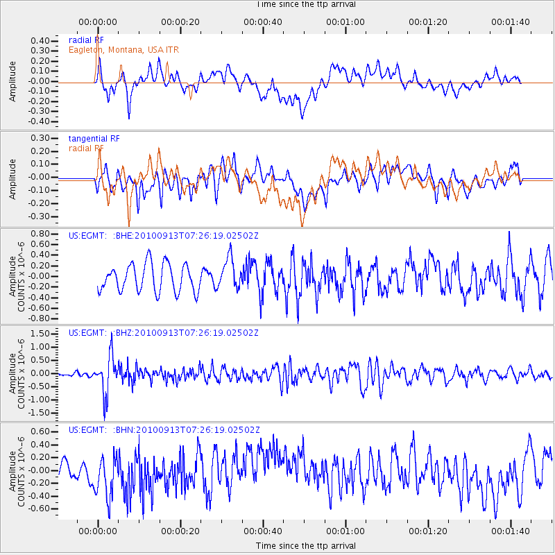
EGMT Eagleton, Montana, USA - Earthquake Result Viewer
*The percent match for this event was below the threshold and hence no stack was calculated.
| Earthquake location: |
Central Peru |
| Earthquake latitude/longitude: |
-14.6/-70.8 |
| Earthquake time(UTC): |
2010/09/13 (256) 07:15:49 GMT |
| Earthquake Depth: |
180 km |
| Earthquake Magnitude: |
5.6 MB, 5.9 MW, 5.8 MW |
| Earthquake Catalog/Contributor: |
WHDF/NEIC |
|
| Network: |
US United States National Seismic Network |
| Station: |
EGMT Eagleton, Montana, USA |
| Lat/Lon: |
48.02 N/109.75 W |
| Elevation: |
1055 m |
|
| Distance: |
71.4 deg |
| Az: |
333.538 deg |
| Baz: |
140.015 deg |
| Ray Param: |
$rayparam |
*The percent match for this event was below the threshold and hence was not used in the summary stack. |
|
| Radial Match: |
36.908974 % |
| Radial Bump: |
400 |
| Transverse Match: |
39.140167 % |
| Transverse Bump: |
400 |
| SOD ConfigId: |
319893 |
| Insert Time: |
2011-01-20 09:17:47.763 +0000 |
| GWidth: |
2.5 |
| Max Bumps: |
400 |
| Tol: |
0.001 |
|
Signal To Noise
| Channel | StoN | STA | LTA |
| US:EGMT: :BHZ:20100913T07:26:19.02502Z | 7.0723305 | 7.347402E-7 | 1.038894E-7 |
| US:EGMT: :BHN:20100913T07:26:19.02502Z | 2.7555864 | 3.58808E-7 | 1.3021113E-7 |
| US:EGMT: :BHE:20100913T07:26:19.02502Z | 1.1356614 | 2.9193612E-7 | 2.5706265E-7 |
| Arrivals |
| Ps | |
| PpPs | |
| PsPs/PpSs | |


