You are here: Home > Network List > US - United States National Seismic Network Stations List
> Station GLMI Grayling, Michigan, USA > Earthquake Result Viewer
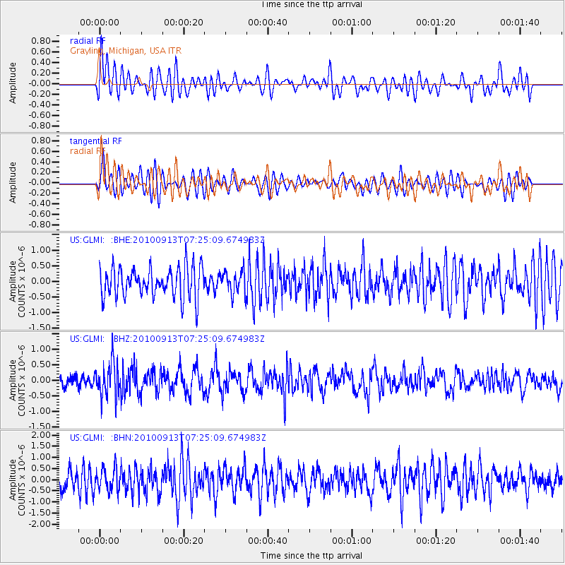
GLMI Grayling, Michigan, USA - Earthquake Result Viewer
*The percent match for this event was below the threshold and hence no stack was calculated.
| Earthquake location: |
Central Peru |
| Earthquake latitude/longitude: |
-14.6/-70.8 |
| Earthquake time(UTC): |
2010/09/13 (256) 07:15:49 GMT |
| Earthquake Depth: |
180 km |
| Earthquake Magnitude: |
5.6 MB, 5.9 MW, 5.8 MW |
| Earthquake Catalog/Contributor: |
WHDF/NEIC |
|
| Network: |
US United States National Seismic Network |
| Station: |
GLMI Grayling, Michigan, USA |
| Lat/Lon: |
44.82 N/84.62 W |
| Elevation: |
387 m |
|
| Distance: |
60.5 deg |
| Az: |
348.718 deg |
| Baz: |
164.565 deg |
| Ray Param: |
$rayparam |
*The percent match for this event was below the threshold and hence was not used in the summary stack. |
|
| Radial Match: |
55.763348 % |
| Radial Bump: |
400 |
| Transverse Match: |
61.75356 % |
| Transverse Bump: |
400 |
| SOD ConfigId: |
319893 |
| Insert Time: |
2011-01-20 09:18:11.891 +0000 |
| GWidth: |
2.5 |
| Max Bumps: |
400 |
| Tol: |
0.001 |
|
Signal To Noise
| Channel | StoN | STA | LTA |
| US:GLMI: :BHZ:20100913T07:25:09.674983Z | 2.4604368 | 5.773234E-7 | 2.3464264E-7 |
| US:GLMI: :BHN:20100913T07:25:09.674983Z | 0.92787 | 5.230039E-7 | 5.6366076E-7 |
| US:GLMI: :BHE:20100913T07:25:09.674983Z | 0.7704438 | 3.635514E-7 | 4.718727E-7 |
| Arrivals |
| Ps | |
| PpPs | |
| PsPs/PpSs | |


