You are here: Home > Network List > UW - Pacific Northwest Regional Seismic Network Stations List
> Station LEBA Lebam, WA, USA > Earthquake Result Viewer
LEBA Lebam, WA, USA - Earthquake Result Viewer
*The percent match for this event was below the threshold and hence no stack was calculated.
| Earthquake location: |
Central Peru |
| Earthquake latitude/longitude: |
-14.6/-70.8 |
| Earthquake time(UTC): |
2010/09/13 (256) 07:15:49 GMT |
| Earthquake Depth: |
180 km |
| Earthquake Magnitude: |
5.6 MB, 5.9 MW, 5.8 MW |
| Earthquake Catalog/Contributor: |
WHDF/NEIC |
|
| Network: |
UW Pacific Northwest Regional Seismic Network |
| Station: |
LEBA Lebam, WA, USA |
| Lat/Lon: |
46.55 N/123.56 W |
| Elevation: |
73 m |
|
| Distance: |
77.1 deg |
| Az: |
325.679 deg |
| Baz: |
127.738 deg |
| Ray Param: |
$rayparam |
*The percent match for this event was below the threshold and hence was not used in the summary stack. |
|
| Radial Match: |
74.0678 % |
| Radial Bump: |
400 |
| Transverse Match: |
73.23996 % |
| Transverse Bump: |
400 |
| SOD ConfigId: |
319893 |
| Insert Time: |
2011-01-20 09:19:47.251 +0000 |
| GWidth: |
2.5 |
| Max Bumps: |
400 |
| Tol: |
0.001 |
|
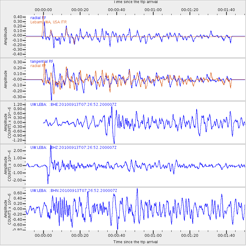
Signal To Noise
| Channel | StoN | STA | LTA |
| UW:LEBA: :BHZ:20100913T07:26:52.200007Z | 5.0167885 | 1.0590131E-6 | 2.1109383E-7 |
| UW:LEBA: :BHN:20100913T07:26:52.200007Z | 1.3804044 | 1.9876244E-7 | 1.4398856E-7 |
| UW:LEBA: :BHE:20100913T07:26:52.200007Z | 2.3693476 | 3.6921483E-7 | 1.5582975E-7 |
| Arrivals |
| Ps | |
| PpPs | |
| PsPs/PpSs | |


