You are here: Home > Network List > CI - Caltech Regional Seismic Network Stations List
> Station SLA SLA, Trona, CA, USA > Earthquake Result Viewer
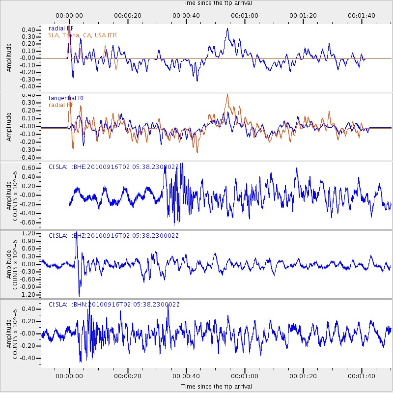
SLA SLA, Trona, CA, USA - Earthquake Result Viewer
*The percent match for this event was below the threshold and hence no stack was calculated.
| Earthquake location: |
Tonga Islands |
| Earthquake latitude/longitude: |
-16.0/-174.0 |
| Earthquake time(UTC): |
2010/09/16 (259) 01:54:40 GMT |
| Earthquake Depth: |
84 km |
| Earthquake Magnitude: |
5.5 MB, 5.8 MW, 5.8 MW |
| Earthquake Catalog/Contributor: |
WHDF/NEIC |
|
| Network: |
CI Caltech Regional Seismic Network |
| Station: |
SLA SLA, Trona, CA, USA |
| Lat/Lon: |
35.89 N/117.28 W |
| Elevation: |
1174 m |
|
| Distance: |
74.4 deg |
| Az: |
44.782 deg |
| Baz: |
236.532 deg |
| Ray Param: |
$rayparam |
*The percent match for this event was below the threshold and hence was not used in the summary stack. |
|
| Radial Match: |
63.465378 % |
| Radial Bump: |
400 |
| Transverse Match: |
64.60753 % |
| Transverse Bump: |
400 |
| SOD ConfigId: |
319893 |
| Insert Time: |
2011-01-20 09:28:26.391 +0000 |
| GWidth: |
2.5 |
| Max Bumps: |
400 |
| Tol: |
0.001 |
|
Signal To Noise
| Channel | StoN | STA | LTA |
| CI:SLA: :BHZ:20100916T02:05:38.230002Z | 6.439587 | 4.8053494E-7 | 7.462201E-8 |
| CI:SLA: :BHN:20100916T02:05:38.230002Z | 2.9029257 | 1.6131096E-7 | 5.5568407E-8 |
| CI:SLA: :BHE:20100916T02:05:38.230002Z | 2.4147606 | 2.67245E-7 | 1.1067144E-7 |
| Arrivals |
| Ps | |
| PpPs | |
| PsPs/PpSs | |


