You are here: Home > Network List > CI - Caltech Regional Seismic Network Stations List
> Station SMM Simmler, CA, USA > Earthquake Result Viewer
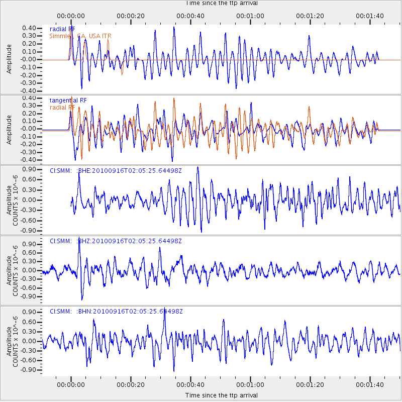
SMM Simmler, CA, USA - Earthquake Result Viewer
*The percent match for this event was below the threshold and hence no stack was calculated.
| Earthquake location: |
Tonga Islands |
| Earthquake latitude/longitude: |
-16.0/-174.0 |
| Earthquake time(UTC): |
2010/09/16 (259) 01:54:40 GMT |
| Earthquake Depth: |
84 km |
| Earthquake Magnitude: |
5.5 MB, 5.8 MW, 5.8 MW |
| Earthquake Catalog/Contributor: |
WHDF/NEIC |
|
| Network: |
CI Caltech Regional Seismic Network |
| Station: |
SMM Simmler, CA, USA |
| Lat/Lon: |
35.31 N/120.00 W |
| Elevation: |
599 m |
|
| Distance: |
72.3 deg |
| Az: |
43.975 deg |
| Baz: |
234.728 deg |
| Ray Param: |
$rayparam |
*The percent match for this event was below the threshold and hence was not used in the summary stack. |
|
| Radial Match: |
62.540043 % |
| Radial Bump: |
400 |
| Transverse Match: |
60.462708 % |
| Transverse Bump: |
400 |
| SOD ConfigId: |
319893 |
| Insert Time: |
2011-01-20 09:28:40.374 +0000 |
| GWidth: |
2.5 |
| Max Bumps: |
400 |
| Tol: |
0.001 |
|
Signal To Noise
| Channel | StoN | STA | LTA |
| CI:SMM: :BHZ:20100916T02:05:25.64498Z | 4.9748135 | 4.5152825E-7 | 9.0762846E-8 |
| CI:SMM: :BHN:20100916T02:05:25.64498Z | 0.9681693 | 1.6651103E-7 | 1.7198546E-7 |
| CI:SMM: :BHE:20100916T02:05:25.64498Z | 1.6234845 | 3.2369186E-7 | 1.9938093E-7 |
| Arrivals |
| Ps | |
| PpPs | |
| PsPs/PpSs | |


