You are here: Home > Network List > G - GEOSCOPE Stations List
> Station INU Inuyama, Japan > Earthquake Result Viewer
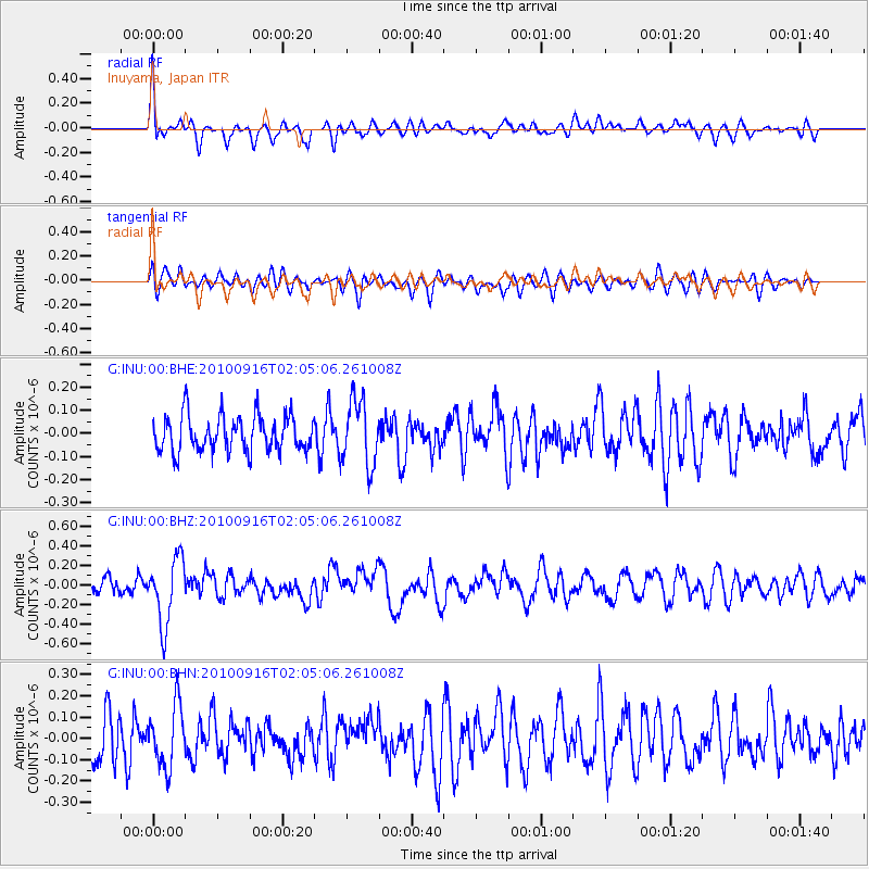
INU Inuyama, Japan - Earthquake Result Viewer
*The percent match for this event was below the threshold and hence no stack was calculated.
| Earthquake location: |
Tonga Islands |
| Earthquake latitude/longitude: |
-16.0/-174.0 |
| Earthquake time(UTC): |
2010/09/16 (259) 01:54:40 GMT |
| Earthquake Depth: |
84 km |
| Earthquake Magnitude: |
5.5 MB, 5.8 MW, 5.8 MW |
| Earthquake Catalog/Contributor: |
WHDF/NEIC |
|
| Network: |
G GEOSCOPE |
| Station: |
INU Inuyama, Japan |
| Lat/Lon: |
35.35 N/137.03 E |
| Elevation: |
132 m |
|
| Distance: |
69.1 deg |
| Az: |
318.645 deg |
| Baz: |
128.993 deg |
| Ray Param: |
$rayparam |
*The percent match for this event was below the threshold and hence was not used in the summary stack. |
|
| Radial Match: |
68.20577 % |
| Radial Bump: |
400 |
| Transverse Match: |
49.465836 % |
| Transverse Bump: |
400 |
| SOD ConfigId: |
319893 |
| Insert Time: |
2011-01-20 09:29:34.168 +0000 |
| GWidth: |
2.5 |
| Max Bumps: |
400 |
| Tol: |
0.001 |
|
Signal To Noise
| Channel | StoN | STA | LTA |
| G:INU:00:BHZ:20100916T02:05:06.261008Z | 3.4431722 | 3.3705084E-7 | 9.7889625E-8 |
| G:INU:00:BHN:20100916T02:05:06.261008Z | 1.4891828 | 1.4139867E-7 | 9.4950515E-8 |
| G:INU:00:BHE:20100916T02:05:06.261008Z | 1.8377309 | 1.417412E-7 | 7.712837E-8 |
| Arrivals |
| Ps | |
| PpPs | |
| PsPs/PpSs | |


