You are here: Home > Network List > IW - Intermountain West Stations List
> Station MOOW Moose Ponds, Wyoming, USA > Earthquake Result Viewer
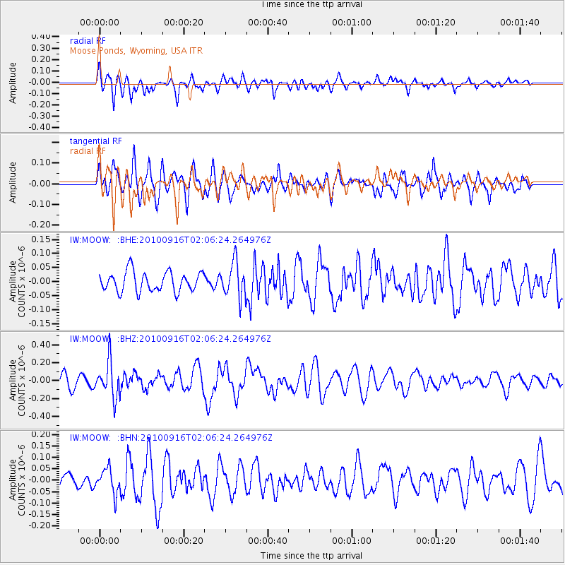
MOOW Moose Ponds, Wyoming, USA - Earthquake Result Viewer
*The percent match for this event was below the threshold and hence no stack was calculated.
| Earthquake location: |
Tonga Islands |
| Earthquake latitude/longitude: |
-16.0/-174.0 |
| Earthquake time(UTC): |
2010/09/16 (259) 01:54:40 GMT |
| Earthquake Depth: |
84 km |
| Earthquake Magnitude: |
5.5 MB, 5.8 MW, 5.8 MW |
| Earthquake Catalog/Contributor: |
WHDF/NEIC |
|
| Network: |
IW Intermountain West |
| Station: |
MOOW Moose Ponds, Wyoming, USA |
| Lat/Lon: |
43.75 N/110.74 W |
| Elevation: |
2128 m |
|
| Distance: |
82.8 deg |
| Az: |
40.696 deg |
| Baz: |
239.906 deg |
| Ray Param: |
$rayparam |
*The percent match for this event was below the threshold and hence was not used in the summary stack. |
|
| Radial Match: |
60.47181 % |
| Radial Bump: |
400 |
| Transverse Match: |
59.503098 % |
| Transverse Bump: |
400 |
| SOD ConfigId: |
319893 |
| Insert Time: |
2011-01-20 09:30:47.382 +0000 |
| GWidth: |
2.5 |
| Max Bumps: |
400 |
| Tol: |
0.001 |
|
Signal To Noise
| Channel | StoN | STA | LTA |
| IW:MOOW: :BHZ:20100916T02:06:24.264976Z | 2.5594335 | 2.0500785E-7 | 8.0098914E-8 |
| IW:MOOW: :BHN:20100916T02:06:24.264976Z | 1.2147455 | 5.457661E-8 | 4.492843E-8 |
| IW:MOOW: :BHE:20100916T02:06:24.264976Z | 1.8314191 | 6.3895556E-8 | 3.4888547E-8 |
| Arrivals |
| Ps | |
| PpPs | |
| PsPs/PpSs | |


