You are here: Home > Network List > TA - USArray Transportable Network (new EarthScope stations) Stations List
> Station Y12C Blythe, CA, USA > Earthquake Result Viewer
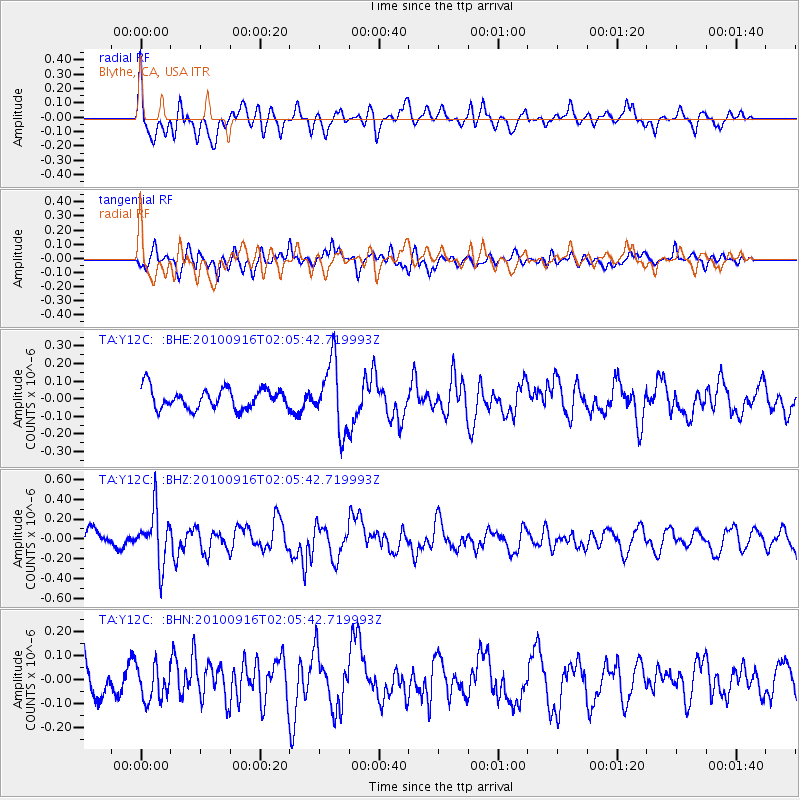
Y12C Blythe, CA, USA - Earthquake Result Viewer
*The percent match for this event was below the threshold and hence no stack was calculated.
| Earthquake location: |
Tonga Islands |
| Earthquake latitude/longitude: |
-16.0/-174.0 |
| Earthquake time(UTC): |
2010/09/16 (259) 01:54:40 GMT |
| Earthquake Depth: |
84 km |
| Earthquake Magnitude: |
5.5 MB, 5.8 MW, 5.8 MW |
| Earthquake Catalog/Contributor: |
WHDF/NEIC |
|
| Network: |
TA USArray Transportable Network (new EarthScope stations) |
| Station: |
Y12C Blythe, CA, USA |
| Lat/Lon: |
33.75 N/114.52 W |
| Elevation: |
196 m |
|
| Distance: |
75.2 deg |
| Az: |
47.909 deg |
| Baz: |
238.921 deg |
| Ray Param: |
$rayparam |
*The percent match for this event was below the threshold and hence was not used in the summary stack. |
|
| Radial Match: |
64.58113 % |
| Radial Bump: |
400 |
| Transverse Match: |
59.54751 % |
| Transverse Bump: |
400 |
| SOD ConfigId: |
319893 |
| Insert Time: |
2011-01-20 09:32:41.548 +0000 |
| GWidth: |
2.5 |
| Max Bumps: |
400 |
| Tol: |
0.001 |
|
Signal To Noise
| Channel | StoN | STA | LTA |
| TA:Y12C: :BHZ:20100916T02:05:42.719993Z | 3.355821 | 2.678871E-7 | 7.9827586E-8 |
| TA:Y12C: :BHN:20100916T02:05:42.719993Z | 1.2744784 | 7.110075E-8 | 5.5788114E-8 |
| TA:Y12C: :BHE:20100916T02:05:42.719993Z | 3.3227398 | 1.9080183E-7 | 5.7423044E-8 |
| Arrivals |
| Ps | |
| PpPs | |
| PsPs/PpSs | |


