You are here: Home > Network List > TA - USArray Transportable Network (new EarthScope stations) Stations List
> Station M04C Macdoel, CA, USA > Earthquake Result Viewer
M04C Macdoel, CA, USA - Earthquake Result Viewer
*The percent match for this event was below the threshold and hence no stack was calculated.
| Earthquake location: |
Tonga Islands |
| Earthquake latitude/longitude: |
-16.0/-174.0 |
| Earthquake time(UTC): |
2010/09/16 (259) 01:54:40 GMT |
| Earthquake Depth: |
84 km |
| Earthquake Magnitude: |
5.5 MB, 5.8 MW, 5.8 MW |
| Earthquake Catalog/Contributor: |
WHDF/NEIC |
|
| Network: |
TA USArray Transportable Network (new EarthScope stations) |
| Station: |
M04C Macdoel, CA, USA |
| Lat/Lon: |
41.78 N/121.84 W |
| Elevation: |
1391 m |
|
| Distance: |
75.0 deg |
| Az: |
37.679 deg |
| Baz: |
231.804 deg |
| Ray Param: |
$rayparam |
*The percent match for this event was below the threshold and hence was not used in the summary stack. |
|
| Radial Match: |
69.12562 % |
| Radial Bump: |
400 |
| Transverse Match: |
63.21267 % |
| Transverse Bump: |
400 |
| SOD ConfigId: |
319893 |
| Insert Time: |
2011-01-20 09:32:53.897 +0000 |
| GWidth: |
2.5 |
| Max Bumps: |
400 |
| Tol: |
0.001 |
|
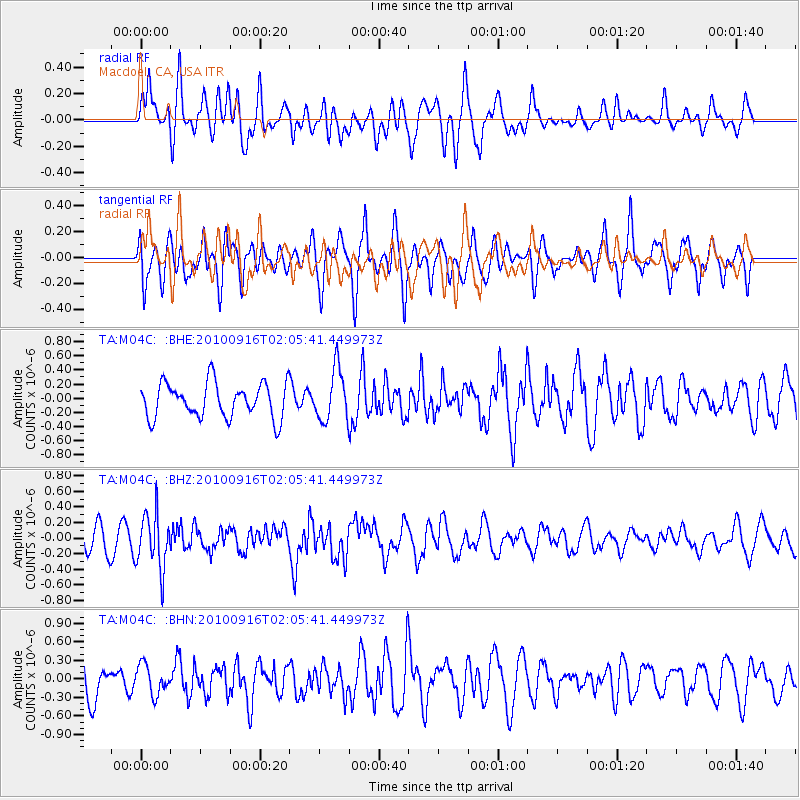
Signal To Noise
| Channel | StoN | STA | LTA |
| TA:M04C: :BHZ:20100916T02:05:41.449973Z | 2.2633853 | 3.4940143E-7 | 1.5437118E-7 |
| TA:M04C: :BHN:20100916T02:05:41.449973Z | 0.7127669 | 2.3738949E-7 | 3.3305346E-7 |
| TA:M04C: :BHE:20100916T02:05:41.449973Z | 1.4901903 | 3.6649553E-7 | 2.4593874E-7 |
| Arrivals |
| Ps | |
| PpPs | |
| PsPs/PpSs | |


