You are here: Home > Network List > TA - USArray Transportable Network (new EarthScope stations) Stations List
> Station R26A Arlington, CO, USA > Earthquake Result Viewer
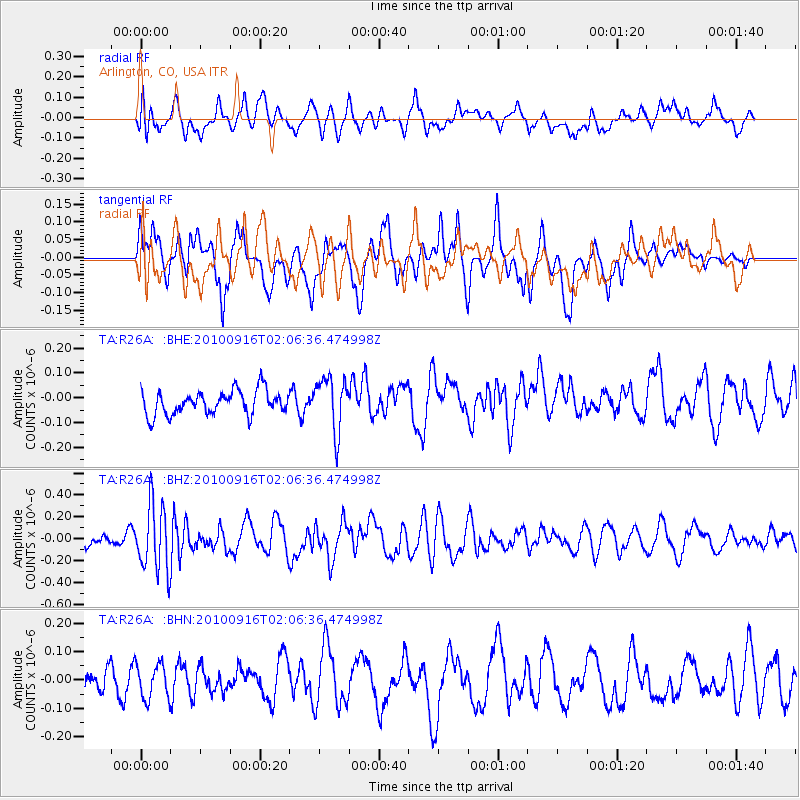
R26A Arlington, CO, USA - Earthquake Result Viewer
*The percent match for this event was below the threshold and hence no stack was calculated.
| Earthquake location: |
Tonga Islands |
| Earthquake latitude/longitude: |
-16.0/-174.0 |
| Earthquake time(UTC): |
2010/09/16 (259) 01:54:40 GMT |
| Earthquake Depth: |
84 km |
| Earthquake Magnitude: |
5.5 MB, 5.8 MW, 5.8 MW |
| Earthquake Catalog/Contributor: |
WHDF/NEIC |
|
| Network: |
TA USArray Transportable Network (new EarthScope stations) |
| Station: |
R26A Arlington, CO, USA |
| Lat/Lon: |
38.30 N/103.45 W |
| Elevation: |
1304 m |
|
| Distance: |
85.2 deg |
| Az: |
48.098 deg |
| Baz: |
245.458 deg |
| Ray Param: |
$rayparam |
*The percent match for this event was below the threshold and hence was not used in the summary stack. |
|
| Radial Match: |
49.77402 % |
| Radial Bump: |
400 |
| Transverse Match: |
47.308987 % |
| Transverse Bump: |
400 |
| SOD ConfigId: |
319893 |
| Insert Time: |
2011-01-20 09:34:08.965 +0000 |
| GWidth: |
2.5 |
| Max Bumps: |
400 |
| Tol: |
0.001 |
|
Signal To Noise
| Channel | StoN | STA | LTA |
| TA:R26A: :BHZ:20100916T02:06:36.474998Z | 3.9801304 | 3.0598548E-7 | 7.687826E-8 |
| TA:R26A: :BHN:20100916T02:06:36.474998Z | 1.2436461 | 6.112784E-8 | 4.915212E-8 |
| TA:R26A: :BHE:20100916T02:06:36.474998Z | 2.2402434 | 1.0758406E-7 | 4.8023377E-8 |
| Arrivals |
| Ps | |
| PpPs | |
| PsPs/PpSs | |


