You are here: Home > Network List > TA - USArray Transportable Network (new EarthScope stations) Stations List
> Station T28A Walsh, CO, USA > Earthquake Result Viewer
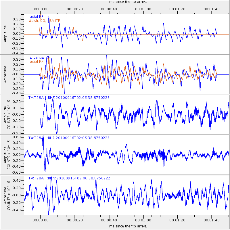
T28A Walsh, CO, USA - Earthquake Result Viewer
*The percent match for this event was below the threshold and hence no stack was calculated.
| Earthquake location: |
Tonga Islands |
| Earthquake latitude/longitude: |
-16.0/-174.0 |
| Earthquake time(UTC): |
2010/09/16 (259) 01:54:40 GMT |
| Earthquake Depth: |
84 km |
| Earthquake Magnitude: |
5.5 MB, 5.8 MW, 5.8 MW |
| Earthquake Catalog/Contributor: |
WHDF/NEIC |
|
| Network: |
TA USArray Transportable Network (new EarthScope stations) |
| Station: |
T28A Walsh, CO, USA |
| Lat/Lon: |
37.12 N/102.11 W |
| Elevation: |
1148 m |
|
| Distance: |
85.7 deg |
| Az: |
49.61 deg |
| Baz: |
246.389 deg |
| Ray Param: |
$rayparam |
*The percent match for this event was below the threshold and hence was not used in the summary stack. |
|
| Radial Match: |
52.239662 % |
| Radial Bump: |
364 |
| Transverse Match: |
51.747284 % |
| Transverse Bump: |
387 |
| SOD ConfigId: |
319893 |
| Insert Time: |
2011-01-20 09:34:42.594 +0000 |
| GWidth: |
2.5 |
| Max Bumps: |
400 |
| Tol: |
0.001 |
|
Signal To Noise
| Channel | StoN | STA | LTA |
| TA:T28A: :BHZ:20100916T02:06:38.875022Z | 2.9225848 | 2.7285884E-7 | 9.336216E-8 |
| TA:T28A: :BHN:20100916T02:06:38.875022Z | 0.89553565 | 1.8733832E-7 | 2.0919136E-7 |
| TA:T28A: :BHE:20100916T02:06:38.875022Z | 0.76664585 | 9.590895E-8 | 1.2510203E-7 |
| Arrivals |
| Ps | |
| PpPs | |
| PsPs/PpSs | |


