You are here: Home > Network List > TA - USArray Transportable Network (new EarthScope stations) Stations List
> Station 332A Millersview, TX, USA > Earthquake Result Viewer
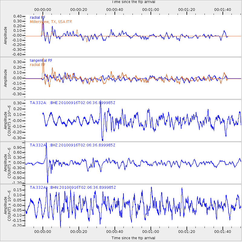
332A Millersview, TX, USA - Earthquake Result Viewer
*The percent match for this event was below the threshold and hence no stack was calculated.
| Earthquake location: |
Tonga Islands |
| Earthquake latitude/longitude: |
-16.0/-174.0 |
| Earthquake time(UTC): |
2010/09/16 (259) 01:54:40 GMT |
| Earthquake Depth: |
84 km |
| Earthquake Magnitude: |
5.5 MB, 5.8 MW, 5.8 MW |
| Earthquake Catalog/Contributor: |
WHDF/NEIC |
|
| Network: |
TA USArray Transportable Network (new EarthScope stations) |
| Station: |
332A Millersview, TX, USA |
| Lat/Lon: |
31.38 N/99.74 W |
| Elevation: |
513 m |
|
| Distance: |
85.3 deg |
| Az: |
55.665 deg |
| Baz: |
248.192 deg |
| Ray Param: |
$rayparam |
*The percent match for this event was below the threshold and hence was not used in the summary stack. |
|
| Radial Match: |
73.438324 % |
| Radial Bump: |
389 |
| Transverse Match: |
50.980633 % |
| Transverse Bump: |
400 |
| SOD ConfigId: |
319893 |
| Insert Time: |
2011-01-20 09:37:29.795 +0000 |
| GWidth: |
2.5 |
| Max Bumps: |
400 |
| Tol: |
0.001 |
|
Signal To Noise
| Channel | StoN | STA | LTA |
| TA:332A: :BHZ:20100916T02:06:36.899985Z | 8.09993 | 4.7682408E-7 | 5.8867684E-8 |
| TA:332A: :BHN:20100916T02:06:36.899985Z | 2.0420098 | 8.881528E-8 | 4.349405E-8 |
| TA:332A: :BHE:20100916T02:06:36.899985Z | 2.771121 | 1.632043E-7 | 5.8894685E-8 |
| Arrivals |
| Ps | |
| PpPs | |
| PsPs/PpSs | |


