You are here: Home > Network List > TA - USArray Transportable Network (new EarthScope stations) Stations List
> Station F29A Eureka, SD, USA > Earthquake Result Viewer
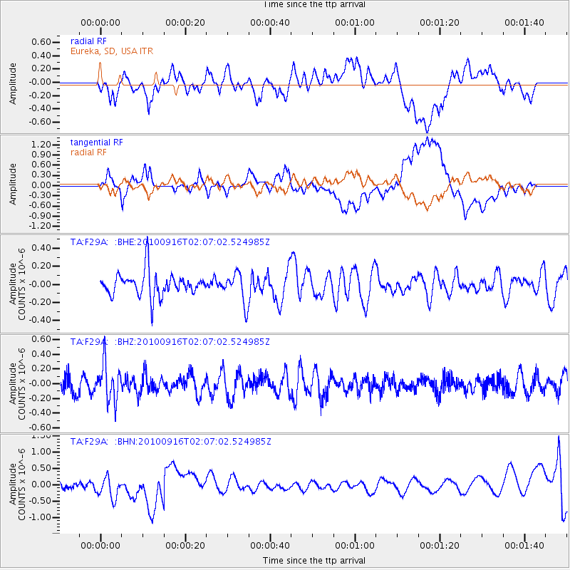
F29A Eureka, SD, USA - Earthquake Result Viewer
*The percent match for this event was below the threshold and hence no stack was calculated.
| Earthquake location: |
Tonga Islands |
| Earthquake latitude/longitude: |
-16.0/-174.0 |
| Earthquake time(UTC): |
2010/09/16 (259) 01:54:40 GMT |
| Earthquake Depth: |
84 km |
| Earthquake Magnitude: |
5.5 MB, 5.8 MW, 5.8 MW |
| Earthquake Catalog/Contributor: |
WHDF/NEIC |
|
| Network: |
TA USArray Transportable Network (new EarthScope stations) |
| Station: |
F29A Eureka, SD, USA |
| Lat/Lon: |
45.83 N/99.83 W |
| Elevation: |
575 m |
|
| Distance: |
90.7 deg |
| Az: |
42.265 deg |
| Baz: |
247.673 deg |
| Ray Param: |
$rayparam |
*The percent match for this event was below the threshold and hence was not used in the summary stack. |
|
| Radial Match: |
52.614708 % |
| Radial Bump: |
400 |
| Transverse Match: |
50.673817 % |
| Transverse Bump: |
400 |
| SOD ConfigId: |
319893 |
| Insert Time: |
2011-01-20 09:41:05.626 +0000 |
| GWidth: |
2.5 |
| Max Bumps: |
400 |
| Tol: |
0.001 |
|
Signal To Noise
| Channel | StoN | STA | LTA |
| TA:F29A: :BHZ:20100916T02:07:02.524985Z | 2.187483 | 2.540036E-7 | 1.1611683E-7 |
| TA:F29A: :BHN:20100916T02:07:02.524985Z | 1.8403925 | 3.2747906E-7 | 1.779398E-7 |
| TA:F29A: :BHE:20100916T02:07:02.524985Z | 1.366681 | 1.7447941E-7 | 1.2766652E-7 |
| Arrivals |
| Ps | |
| PpPs | |
| PsPs/PpSs | |


