You are here: Home > Network List > TA - USArray Transportable Network (new EarthScope stations) Stations List
> Station 333A Richland Springs, TX, USA > Earthquake Result Viewer
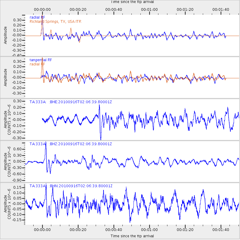
333A Richland Springs, TX, USA - Earthquake Result Viewer
*The percent match for this event was below the threshold and hence no stack was calculated.
| Earthquake location: |
Tonga Islands |
| Earthquake latitude/longitude: |
-16.0/-174.0 |
| Earthquake time(UTC): |
2010/09/16 (259) 01:54:40 GMT |
| Earthquake Depth: |
84 km |
| Earthquake Magnitude: |
5.5 MB, 5.8 MW, 5.8 MW |
| Earthquake Catalog/Contributor: |
WHDF/NEIC |
|
| Network: |
TA USArray Transportable Network (new EarthScope stations) |
| Station: |
333A Richland Springs, TX, USA |
| Lat/Lon: |
31.32 N/98.98 W |
| Elevation: |
443 m |
|
| Distance: |
85.9 deg |
| Az: |
55.959 deg |
| Baz: |
248.607 deg |
| Ray Param: |
$rayparam |
*The percent match for this event was below the threshold and hence was not used in the summary stack. |
|
| Radial Match: |
63.707157 % |
| Radial Bump: |
400 |
| Transverse Match: |
64.156075 % |
| Transverse Bump: |
400 |
| SOD ConfigId: |
319893 |
| Insert Time: |
2011-01-20 09:43:16.379 +0000 |
| GWidth: |
2.5 |
| Max Bumps: |
400 |
| Tol: |
0.001 |
|
Signal To Noise
| Channel | StoN | STA | LTA |
| TA:333A: :BHZ:20100916T02:06:39.80001Z | 4.84579 | 3.5090383E-7 | 7.241416E-8 |
| TA:333A: :BHN:20100916T02:06:39.80001Z | 1.5483254 | 7.143684E-8 | 4.613813E-8 |
| TA:333A: :BHE:20100916T02:06:39.80001Z | 3.1432695 | 1.3001376E-7 | 4.136259E-8 |
| Arrivals |
| Ps | |
| PpPs | |
| PsPs/PpSs | |


