You are here: Home > Network List > TA - USArray Transportable Network (new EarthScope stations) Stations List
> Station 336A Riesel, TX, USA > Earthquake Result Viewer
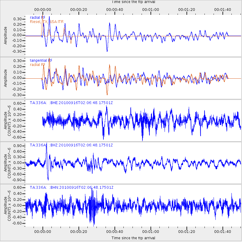
336A Riesel, TX, USA - Earthquake Result Viewer
*The percent match for this event was below the threshold and hence no stack was calculated.
| Earthquake location: |
Tonga Islands |
| Earthquake latitude/longitude: |
-16.0/-174.0 |
| Earthquake time(UTC): |
2010/09/16 (259) 01:54:40 GMT |
| Earthquake Depth: |
84 km |
| Earthquake Magnitude: |
5.5 MB, 5.8 MW, 5.8 MW |
| Earthquake Catalog/Contributor: |
WHDF/NEIC |
|
| Network: |
TA USArray Transportable Network (new EarthScope stations) |
| Station: |
336A Riesel, TX, USA |
| Lat/Lon: |
31.39 N/96.84 W |
| Elevation: |
140 m |
|
| Distance: |
87.6 deg |
| Az: |
56.553 deg |
| Baz: |
249.749 deg |
| Ray Param: |
$rayparam |
*The percent match for this event was below the threshold and hence was not used in the summary stack. |
|
| Radial Match: |
65.30806 % |
| Radial Bump: |
400 |
| Transverse Match: |
59.094494 % |
| Transverse Bump: |
400 |
| SOD ConfigId: |
319893 |
| Insert Time: |
2011-01-20 09:45:39.423 +0000 |
| GWidth: |
2.5 |
| Max Bumps: |
400 |
| Tol: |
0.001 |
|
Signal To Noise
| Channel | StoN | STA | LTA |
| TA:336A: :BHZ:20100916T02:06:48.17501Z | 5.327868 | 4.176791E-7 | 7.839517E-8 |
| TA:336A: :BHN:20100916T02:06:48.17501Z | 1.3010347 | 1.8092975E-7 | 1.3906605E-7 |
| TA:336A: :BHE:20100916T02:06:48.17501Z | 1.8307635 | 2.3399572E-7 | 1.278132E-7 |
| Arrivals |
| Ps | |
| PpPs | |
| PsPs/PpSs | |


