You are here: Home > Network List > TA - USArray Transportable Network (new EarthScope stations) Stations List
> Station Y35A Marietta, OK, USA > Earthquake Result Viewer
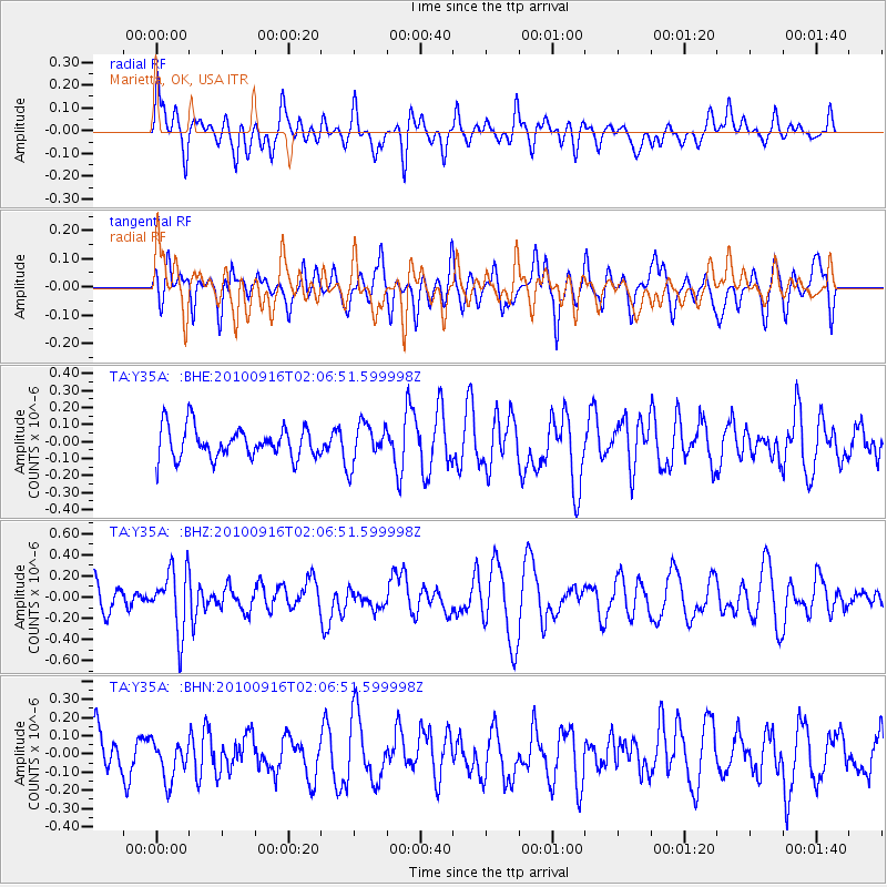
Y35A Marietta, OK, USA - Earthquake Result Viewer
*The percent match for this event was below the threshold and hence no stack was calculated.
| Earthquake location: |
Tonga Islands |
| Earthquake latitude/longitude: |
-16.0/-174.0 |
| Earthquake time(UTC): |
2010/09/16 (259) 01:54:40 GMT |
| Earthquake Depth: |
84 km |
| Earthquake Magnitude: |
5.5 MB, 5.8 MW, 5.8 MW |
| Earthquake Catalog/Contributor: |
WHDF/NEIC |
|
| Network: |
TA USArray Transportable Network (new EarthScope stations) |
| Station: |
Y35A Marietta, OK, USA |
| Lat/Lon: |
33.91 N/97.04 W |
| Elevation: |
214 m |
|
| Distance: |
88.4 deg |
| Az: |
54.139 deg |
| Baz: |
249.561 deg |
| Ray Param: |
$rayparam |
*The percent match for this event was below the threshold and hence was not used in the summary stack. |
|
| Radial Match: |
46.96399 % |
| Radial Bump: |
400 |
| Transverse Match: |
50.989006 % |
| Transverse Bump: |
400 |
| SOD ConfigId: |
319893 |
| Insert Time: |
2011-01-20 09:47:30.652 +0000 |
| GWidth: |
2.5 |
| Max Bumps: |
400 |
| Tol: |
0.001 |
|
Signal To Noise
| Channel | StoN | STA | LTA |
| TA:Y35A: :BHZ:20100916T02:06:51.599998Z | 2.1302395 | 2.9311977E-7 | 1.3759946E-7 |
| TA:Y35A: :BHN:20100916T02:06:51.599998Z | 1.099762 | 1.0656264E-7 | 9.6896095E-8 |
| TA:Y35A: :BHE:20100916T02:06:51.599998Z | 1.297862 | 1.17662594E-7 | 9.065879E-8 |
| Arrivals |
| Ps | |
| PpPs | |
| PsPs/PpSs | |


