You are here: Home > Network List > TA - USArray Transportable Network (new EarthScope stations) Stations List
> Station Z37A Pogue Cattle Company, Sulphur Springs, TX, USA > Earthquake Result Viewer
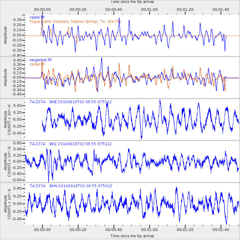
Z37A Pogue Cattle Company, Sulphur Springs, TX, USA - Earthquake Result Viewer
*The percent match for this event was below the threshold and hence no stack was calculated.
| Earthquake location: |
Tonga Islands |
| Earthquake latitude/longitude: |
-16.0/-174.0 |
| Earthquake time(UTC): |
2010/09/16 (259) 01:54:40 GMT |
| Earthquake Depth: |
84 km |
| Earthquake Magnitude: |
5.5 MB, 5.8 MW, 5.8 MW |
| Earthquake Catalog/Contributor: |
WHDF/NEIC |
|
| Network: |
TA USArray Transportable Network (new EarthScope stations) |
| Station: |
Z37A Pogue Cattle Company, Sulphur Springs, TX, USA |
| Lat/Lon: |
33.20 N/95.62 W |
| Elevation: |
146 m |
|
| Distance: |
89.2 deg |
| Az: |
55.208 deg |
| Baz: |
250.362 deg |
| Ray Param: |
$rayparam |
*The percent match for this event was below the threshold and hence was not used in the summary stack. |
|
| Radial Match: |
57.301556 % |
| Radial Bump: |
393 |
| Transverse Match: |
55.24701 % |
| Transverse Bump: |
375 |
| SOD ConfigId: |
319893 |
| Insert Time: |
2011-01-20 09:47:53.998 +0000 |
| GWidth: |
2.5 |
| Max Bumps: |
400 |
| Tol: |
0.001 |
|
Signal To Noise
| Channel | StoN | STA | LTA |
| TA:Z37A: :BHZ:20100916T02:06:55.67501Z | 1.9898858 | 2.704884E-7 | 1.3593163E-7 |
| TA:Z37A: :BHN:20100916T02:06:55.67501Z | 0.8689043 | 1.4565906E-7 | 1.6763533E-7 |
| TA:Z37A: :BHE:20100916T02:06:55.67501Z | 1.6732022 | 2.5646403E-7 | 1.5327737E-7 |
| Arrivals |
| Ps | |
| PpPs | |
| PsPs/PpSs | |


