You are here: Home > Network List > US - United States National Seismic Network Stations List
> Station WMOK Wichita Mountains, Oklahoma, USA > Earthquake Result Viewer
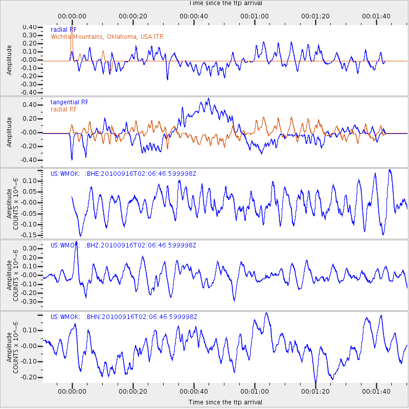
WMOK Wichita Mountains, Oklahoma, USA - Earthquake Result Viewer
*The percent match for this event was below the threshold and hence no stack was calculated.
| Earthquake location: |
Tonga Islands |
| Earthquake latitude/longitude: |
-16.0/-174.0 |
| Earthquake time(UTC): |
2010/09/16 (259) 01:54:40 GMT |
| Earthquake Depth: |
84 km |
| Earthquake Magnitude: |
5.5 MB, 5.8 MW, 5.8 MW |
| Earthquake Catalog/Contributor: |
WHDF/NEIC |
|
| Network: |
US United States National Seismic Network |
| Station: |
WMOK Wichita Mountains, Oklahoma, USA |
| Lat/Lon: |
34.74 N/98.78 W |
| Elevation: |
486 m |
|
| Distance: |
87.3 deg |
| Az: |
52.847 deg |
| Baz: |
248.534 deg |
| Ray Param: |
$rayparam |
*The percent match for this event was below the threshold and hence was not used in the summary stack. |
|
| Radial Match: |
64.006165 % |
| Radial Bump: |
400 |
| Transverse Match: |
51.556877 % |
| Transverse Bump: |
400 |
| SOD ConfigId: |
319893 |
| Insert Time: |
2011-01-20 09:50:52.942 +0000 |
| GWidth: |
2.5 |
| Max Bumps: |
400 |
| Tol: |
0.001 |
|
Signal To Noise
| Channel | StoN | STA | LTA |
| US:WMOK: :BHZ:20100916T02:06:46.599998Z | 2.3646955 | 1.7216824E-7 | 7.280779E-8 |
| US:WMOK: :BHN:20100916T02:06:46.599998Z | 2.0161784 | 1.2200809E-7 | 6.051453E-8 |
| US:WMOK: :BHE:20100916T02:06:46.599998Z | 1.0463271 | 5.265738E-8 | 5.0325927E-8 |
| Arrivals |
| Ps | |
| PpPs | |
| PsPs/PpSs | |


