KNW AZ.KNW - Earthquake Result Viewer
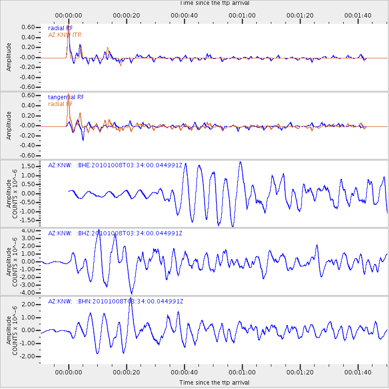
Earthquake location: Andreanof Islands, Aleutian Is.
Earthquake latitude/longitude: 51.4/-175.4
Earthquake time(UTC): 2010/10/08 (281) 03:26:13 GMT
Earthquake Depth: 19 km
Earthquake Magnitude: 6.2 MB, 6.3 MS, 6.4 MW, 6.2 MW
Earthquake Catalog/Contributor: WHDF/NEIC
Network: AZ ANZA Regional Network
Station: KNW AZ.KNW
Lat/Lon: 33.71 N/116.71 W
Elevation: 1507 m
Distance: 45.4 deg
Az: 89.326 deg
Baz: 311.243 deg
Ray Param: 0.07128651
Estimated Moho Depth: 35.5 km
Estimated Crust Vp/Vs: 1.65
Assumed Crust Vp: 6.264 km/s
Estimated Crust Vs: 3.802 km/s
Estimated Crust Poisson's Ratio: 0.21
Radial Match: 92.35027 %
Radial Bump: 311
Transverse Match: 78.73155 %
Transverse Bump: 400
SOD ConfigId: 339645
Insert Time: 2011-02-10 07:36:55.823 +0000
GWidth: 2.5
Max Bumps: 400
Tol: 0.001

Signal To Noise

ChannelStoNSTALTA
AZ:KNW: :BHZ:20101008T03:34:00.044991Z3.53189337.86459E-72.2267349E-7
AZ:KNW: :BHN:20101008T03:34:00.044991Z1.64043723.4941183E-72.1299921E-7
AZ:KNW: :BHE:20101008T03:34:00.044991Z1.59559262.2322817E-71.39903E-7
Arrivals
Ps3.9 SECOND
PpPs14 SECOND
PsPs/PpSs18 SECOND