You are here: Home > Network List > US - United States National Seismic Network Stations List
> Station CBKS Cedar Bluff, Kansas, USA > Earthquake Result Viewer
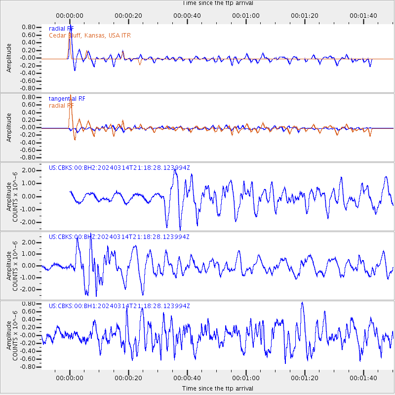
CBKS Cedar Bluff, Kansas, USA - Earthquake Result Viewer
*The percent match for this event was below the threshold and hence no stack was calculated.
| Earthquake location: |
Northern Mid-Atlantic Ridge |
| Earthquake latitude/longitude: |
29.8/-42.7 |
| Earthquake time(UTC): |
2024/03/14 (074) 21:10:25 GMT |
| Earthquake Depth: |
10 km |
| Earthquake Magnitude: |
6.0 mww |
| Earthquake Catalog/Contributor: |
NEIC PDE/us |
|
| Network: |
US United States National Seismic Network |
| Station: |
CBKS Cedar Bluff, Kansas, USA |
| Lat/Lon: |
38.81 N/99.74 W |
| Elevation: |
677 m |
|
| Distance: |
47.3 deg |
| Az: |
296.87 deg |
| Baz: |
82.823 deg |
| Ray Param: |
$rayparam |
*The percent match for this event was below the threshold and hence was not used in the summary stack. |
|
| Radial Match: |
77.237854 % |
| Radial Bump: |
389 |
| Transverse Match: |
57.924427 % |
| Transverse Bump: |
400 |
| SOD ConfigId: |
33437571 |
| Insert Time: |
2024-03-28 21:47:45.735 +0000 |
| GWidth: |
2.5 |
| Max Bumps: |
400 |
| Tol: |
0.001 |
|
Signal To Noise
| Channel | StoN | STA | LTA |
| US:CBKS:00:BHZ:20240314T21:18:28.123994Z | 4.4671016 | 9.1758017E-7 | 2.0540838E-7 |
| US:CBKS:00:BH1:20240314T21:18:28.123994Z | 0.5760113 | 7.733044E-8 | 1.3425161E-7 |
| US:CBKS:00:BH2:20240314T21:18:28.123994Z | 3.4285388 | 9.117441E-7 | 2.659279E-7 |
| Arrivals |
| Ps | |
| PpPs | |
| PsPs/PpSs | |


