You are here: Home > Network List > UW - Pacific Northwest Regional Seismic Network Stations List
> Station HOOD Mt Hood Meadows, OR CREST BB SMO > Earthquake Result Viewer
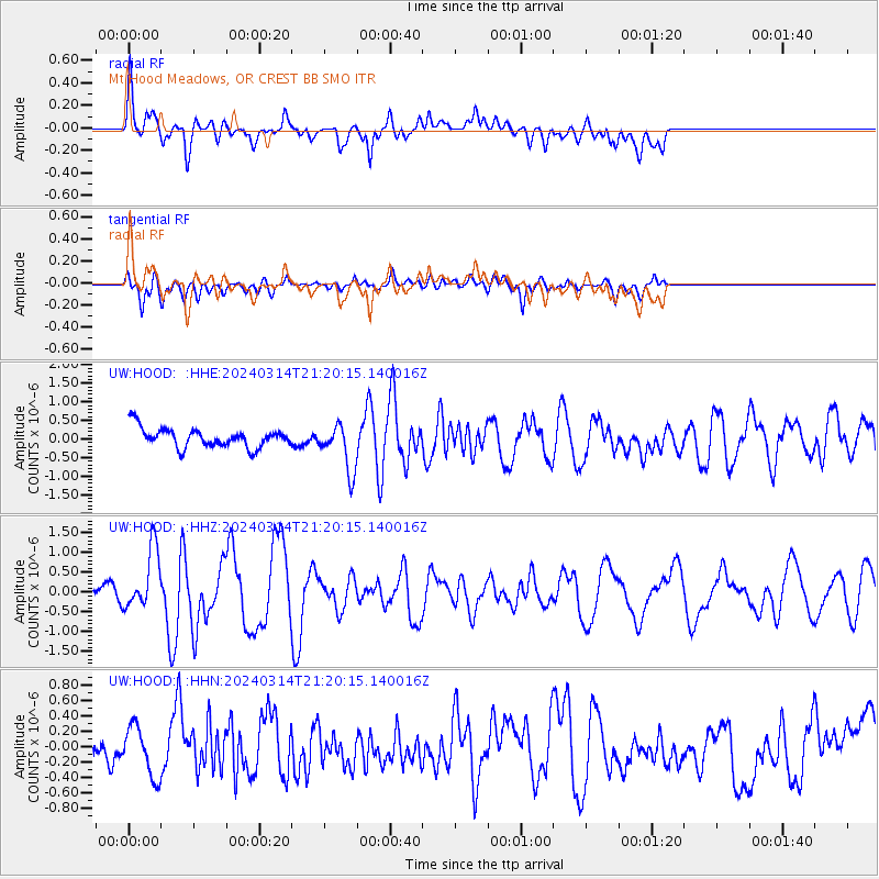
HOOD Mt Hood Meadows, OR CREST BB SMO - Earthquake Result Viewer
*The percent match for this event was below the threshold and hence no stack was calculated.
| Earthquake location: |
Northern Mid-Atlantic Ridge |
| Earthquake latitude/longitude: |
29.8/-42.7 |
| Earthquake time(UTC): |
2024/03/14 (074) 21:10:25 GMT |
| Earthquake Depth: |
10 km |
| Earthquake Magnitude: |
6.0 mww |
| Earthquake Catalog/Contributor: |
NEIC PDE/us |
|
| Network: |
UW Pacific Northwest Regional Seismic Network |
| Station: |
HOOD Mt Hood Meadows, OR CREST BB SMO |
| Lat/Lon: |
45.32 N/121.65 W |
| Elevation: |
1520 m |
|
| Distance: |
62.1 deg |
| Az: |
308.412 deg |
| Baz: |
74.809 deg |
| Ray Param: |
$rayparam |
*The percent match for this event was below the threshold and hence was not used in the summary stack. |
|
| Radial Match: |
67.555595 % |
| Radial Bump: |
400 |
| Transverse Match: |
39.844677 % |
| Transverse Bump: |
400 |
| SOD ConfigId: |
33437571 |
| Insert Time: |
2024-03-28 21:50:15.759 +0000 |
| GWidth: |
2.5 |
| Max Bumps: |
400 |
| Tol: |
0.001 |
|
Signal To Noise
| Channel | StoN | STA | LTA |
| UW:HOOD: :HHZ:20240314T21:20:15.140016Z | 3.9486651 | 7.7170483E-7 | 1.9543437E-7 |
| UW:HOOD: :HHN:20240314T21:20:15.140016Z | 0.74155885 | 3.2101443E-7 | 4.3289137E-7 |
| UW:HOOD: :HHE:20240314T21:20:15.140016Z | 2.478181 | 6.3930275E-7 | 2.579726E-7 |
| Arrivals |
| Ps | |
| PpPs | |
| PsPs/PpSs | |


