You are here: Home > Network List > UW - Pacific Northwest Regional Seismic Network Stations List
> Station UMAT Pilot Rock, OR, USA > Earthquake Result Viewer
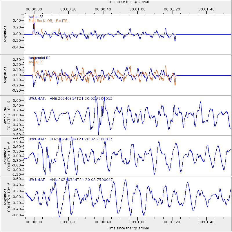
UMAT Pilot Rock, OR, USA - Earthquake Result Viewer
*The percent match for this event was below the threshold and hence no stack was calculated.
| Earthquake location: |
Northern Mid-Atlantic Ridge |
| Earthquake latitude/longitude: |
29.8/-42.7 |
| Earthquake time(UTC): |
2024/03/14 (074) 21:10:25 GMT |
| Earthquake Depth: |
10 km |
| Earthquake Magnitude: |
6.0 mww |
| Earthquake Catalog/Contributor: |
NEIC PDE/us |
|
| Network: |
UW Pacific Northwest Regional Seismic Network |
| Station: |
UMAT Pilot Rock, OR, USA |
| Lat/Lon: |
45.29 N/118.96 W |
| Elevation: |
1318 m |
|
| Distance: |
60.3 deg |
| Az: |
307.839 deg |
| Baz: |
76.442 deg |
| Ray Param: |
$rayparam |
*The percent match for this event was below the threshold and hence was not used in the summary stack. |
|
| Radial Match: |
60.55782 % |
| Radial Bump: |
400 |
| Transverse Match: |
74.37347 % |
| Transverse Bump: |
393 |
| SOD ConfigId: |
33437571 |
| Insert Time: |
2024-03-28 21:52:02.964 +0000 |
| GWidth: |
2.5 |
| Max Bumps: |
400 |
| Tol: |
0.001 |
|
Signal To Noise
| Channel | StoN | STA | LTA |
| UW:UMAT: :HHZ:20240314T21:20:02.750001Z | 3.389311 | 5.2666735E-7 | 1.5539067E-7 |
| UW:UMAT: :HHN:20240314T21:20:02.750001Z | 0.79548234 | 1.4989885E-7 | 1.8843768E-7 |
| UW:UMAT: :HHE:20240314T21:20:02.750001Z | 1.7858595 | 3.2233365E-7 | 1.8049217E-7 |
| Arrivals |
| Ps | |
| PpPs | |
| PsPs/PpSs | |


