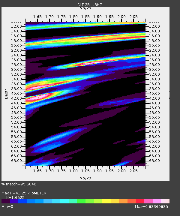
DGR Domenigoni Reservoir, California, USA - Earthquake Result Viewer

Earthquake location: Andreanof Islands, Aleutian Is.
Earthquake latitude/longitude: 51.4/-175.4
Earthquake time(UTC): 2010/10/08 (281) 03:26:13 GMT
Earthquake Depth: 19 km
Earthquake Magnitude: 6.2 MB, 6.3 MS, 6.4 MW, 6.2 MW
Earthquake Catalog/Contributor: WHDF/NEIC
Network: CI Caltech Regional Seismic Network
Station: DGR Domenigoni Reservoir, California, USA
Lat/Lon: 33.65 N/117.01 W
Elevation: 609 m
Distance: 45.2 deg
Az: 89.624 deg
Baz: 311.288 deg
Ray Param: 0.071381755
Estimated Moho Depth: 41.25 km
Estimated Crust Vp/Vs: 1.65
Assumed Crust Vp: 6.264 km/s
Estimated Crust Vs: 3.79 km/s
Estimated Crust Poisson's Ratio: 0.21
Radial Match: 95.6046 %
Radial Bump: 275
Transverse Match: 87.80353 %
Transverse Bump: 400
SOD ConfigId: 339645
Insert Time: 2011-02-10 07:40:17.966 +0000
GWidth: 2.5
Max Bumps: 400
Tol: 0.001

Signal To Noise

ChannelStoNSTALTA
CI:DGR: :BHZ:20101008T03:33:58.919991Z5.42344057.2062267E-71.3287186E-7
CI:DGR: :BHN:20101008T03:33:58.919991Z1.73253833.5243963E-72.0342385E-7
CI:DGR: :BHE:20101008T03:33:58.919991Z2.19802764.3382883E-71.9737188E-7
Arrivals
Ps4.6 SECOND
PpPs16 SECOND
PsPs/PpSs21 SECOND