BFS Mt Baldy Forest Station - Earthquake Result Viewer
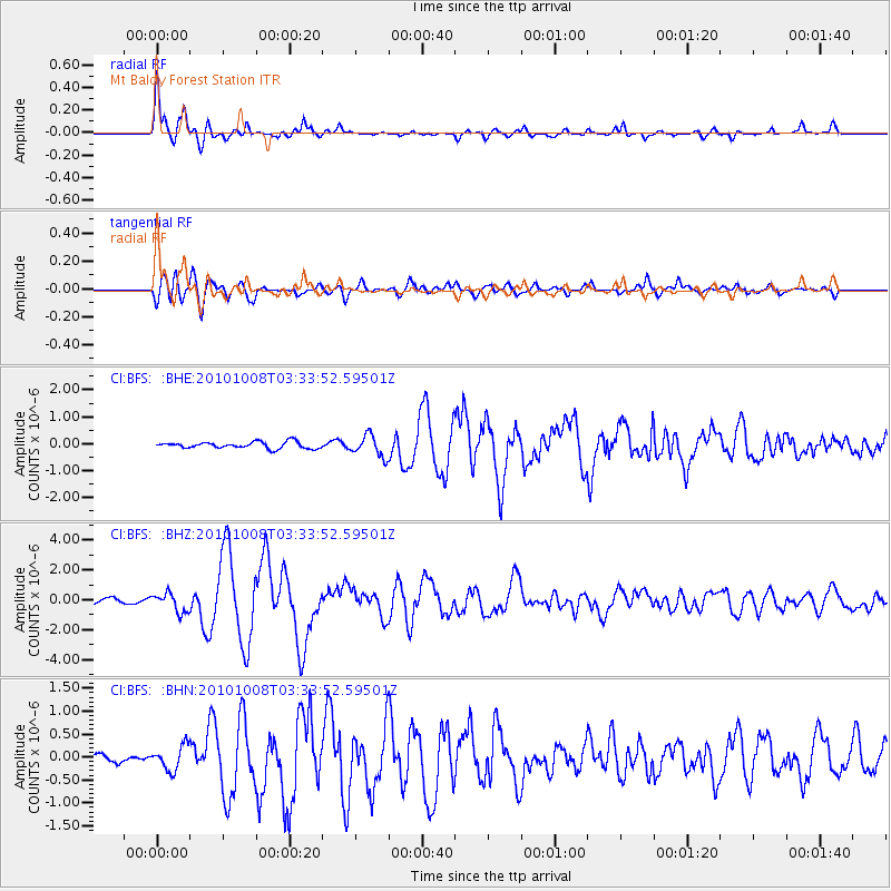
Earthquake location: Andreanof Islands, Aleutian Is.
Earthquake latitude/longitude: 51.4/-175.4
Earthquake time(UTC): 2010/10/08 (281) 03:26:13 GMT
Earthquake Depth: 19 km
Earthquake Magnitude: 6.2 MB, 6.3 MS, 6.4 MW, 6.2 MW
Earthquake Catalog/Contributor: WHDF/NEIC
Network: CI Caltech Regional Seismic Network
Station: BFS Mt Baldy Forest Station
Lat/Lon: 34.24 N/117.66 W
Elevation: 1312 m
Distance: 44.5 deg
Az: 89.498 deg
Baz: 310.839 deg
Ray Param: 0.07188534
Estimated Moho Depth: 33.25 km
Estimated Crust Vp/Vs: 1.74
Assumed Crust Vp: 6.276 km/s
Estimated Crust Vs: 3.617 km/s
Estimated Crust Poisson's Ratio: 0.25
Radial Match: 94.70742 %
Radial Bump: 364
Transverse Match: 85.08899 %
Transverse Bump: 400
SOD ConfigId: 339645
Insert Time: 2011-02-10 07:42:12.602 +0000
GWidth: 2.5
Max Bumps: 400
Tol: 0.001

Signal To Noise

ChannelStoNSTALTA
CI:BFS: :BHZ:20101008T03:33:52.59501Z3.60587676.2176775E-71.7243178E-7
CI:BFS: :BHN:20101008T03:33:52.59501Z2.40743732.6422924E-71.09755405E-7
CI:BFS: :BHE:20101008T03:33:52.59501Z3.3173323.9530138E-71.1916244E-7
Arrivals
Ps4.1 SECOND
PpPs14 SECOND
PsPs/PpSs18 SECOND