MUR Murrieta - Earthquake Result Viewer
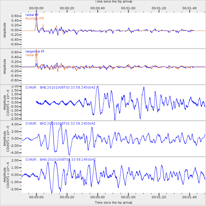
Earthquake location: Andreanof Islands, Aleutian Is.
Earthquake latitude/longitude: 51.4/-175.4
Earthquake time(UTC): 2010/10/08 (281) 03:26:13 GMT
Earthquake Depth: 19 km
Earthquake Magnitude: 6.2 MB, 6.3 MS, 6.4 MW, 6.2 MW
Earthquake Catalog/Contributor: WHDF/NEIC
Network: CI Caltech Regional Seismic Network
Station: MUR Murrieta
Lat/Lon: 33.60 N/117.20 W
Elevation: 562 m
Distance: 45.2 deg
Az: 89.821 deg
Baz: 311.325 deg
Ray Param: 0.07143692
Estimated Moho Depth: 21.75 km
Estimated Crust Vp/Vs: 2.09
Assumed Crust Vp: 6.264 km/s
Estimated Crust Vs: 2.997 km/s
Estimated Crust Poisson's Ratio: 0.35
Radial Match: 92.39866 %
Radial Bump: 379
Transverse Match: 89.684525 %
Transverse Bump: 400
SOD ConfigId: 339645
Insert Time: 2011-02-10 07:42:50.170 +0000
GWidth: 2.5
Max Bumps: 400
Tol: 0.001

Signal To Noise

ChannelStoNSTALTA
CI:MUR: :BHZ:20101008T03:33:58.245004Z4.27923631.0038186E-62.3457889E-7
CI:MUR: :BHN:20101008T03:33:58.245004Z4.4456714.1360536E-79.303553E-8
CI:MUR: :BHE:20101008T03:33:58.245004Z2.15564042.9960358E-71.3898588E-7
Arrivals
Ps4.0 SECOND
PpPs10 SECOND
PsPs/PpSs14 SECOND