You are here: Home > Network List > IW - Intermountain West Stations List
> Station MOOW Moose Ponds, Wyoming, USA > Earthquake Result Viewer
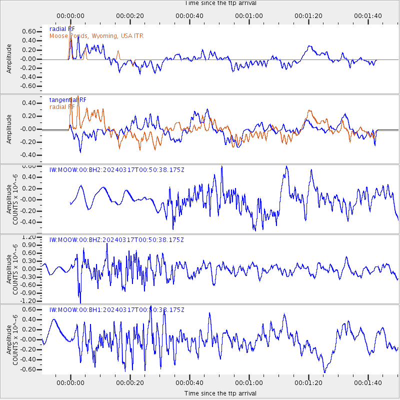
MOOW Moose Ponds, Wyoming, USA - Earthquake Result Viewer
*The percent match for this event was below the threshold and hence no stack was calculated.
| Earthquake location: |
Near Coast Of Nicaragua |
| Earthquake latitude/longitude: |
12.4/-87.7 |
| Earthquake time(UTC): |
2024/03/17 (077) 00:44:03 GMT |
| Earthquake Depth: |
53 km |
| Earthquake Magnitude: |
5.6 mww |
| Earthquake Catalog/Contributor: |
NEIC PDE/us |
|
| Network: |
IW Intermountain West |
| Station: |
MOOW Moose Ponds, Wyoming, USA |
| Lat/Lon: |
43.75 N/110.74 W |
| Elevation: |
2128 m |
|
| Distance: |
37.1 deg |
| Az: |
331.898 deg |
| Baz: |
140.57 deg |
| Ray Param: |
$rayparam |
*The percent match for this event was below the threshold and hence was not used in the summary stack. |
|
| Radial Match: |
54.482246 % |
| Radial Bump: |
400 |
| Transverse Match: |
37.10306 % |
| Transverse Bump: |
400 |
| SOD ConfigId: |
33437571 |
| Insert Time: |
2024-03-31 00:56:52.581 +0000 |
| GWidth: |
2.5 |
| Max Bumps: |
400 |
| Tol: |
0.001 |
|
Signal To Noise
| Channel | StoN | STA | LTA |
| IW:MOOW:00:BHZ:20240317T00:50:38.175Z | 4.855707 | 4.690934E-7 | 9.660661E-8 |
| IW:MOOW:00:BH1:20240317T00:50:38.175Z | 0.82167983 | 2.3498191E-7 | 2.8597745E-7 |
| IW:MOOW:00:BH2:20240317T00:50:38.175Z | 2.2784066 | 2.417043E-7 | 1.0608479E-7 |
| Arrivals |
| Ps | |
| PpPs | |
| PsPs/PpSs | |


