You are here: Home > Network List > IU - Global Seismograph Network (GSN - IRIS/USGS) Stations List
> Station SLBS Sierra la Laguna Baja California Sur, Mexico > Earthquake Result Viewer
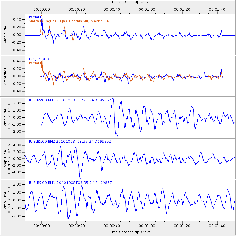
SLBS Sierra la Laguna Baja California Sur, Mexico - Earthquake Result Viewer
*The percent match for this event was below the threshold and hence no stack was calculated.
| Earthquake location: |
Andreanof Islands, Aleutian Is. |
| Earthquake latitude/longitude: |
51.4/-175.4 |
| Earthquake time(UTC): |
2010/10/08 (281) 03:26:13 GMT |
| Earthquake Depth: |
19 km |
| Earthquake Magnitude: |
6.2 MB, 6.3 MS, 6.4 MW, 6.2 MW |
| Earthquake Catalog/Contributor: |
WHDF/NEIC |
|
| Network: |
IU Global Seismograph Network (GSN - IRIS/USGS) |
| Station: |
SLBS Sierra la Laguna Baja California Sur, Mexico |
| Lat/Lon: |
23.69 N/109.94 W |
| Elevation: |
825 m |
|
| Distance: |
56.6 deg |
| Az: |
93.212 deg |
| Baz: |
316.95 deg |
| Ray Param: |
$rayparam |
*The percent match for this event was below the threshold and hence was not used in the summary stack. |
|
| Radial Match: |
69.58265 % |
| Radial Bump: |
398 |
| Transverse Match: |
73.5041 % |
| Transverse Bump: |
363 |
| SOD ConfigId: |
339645 |
| Insert Time: |
2011-02-10 07:45:50.179 +0000 |
| GWidth: |
2.5 |
| Max Bumps: |
400 |
| Tol: |
0.001 |
|
Signal To Noise
| Channel | StoN | STA | LTA |
| IU:SLBS:00:BHZ:20101008T03:35:24.319985Z | 1.999081 | 1.3074497E-6 | 6.5402537E-7 |
| IU:SLBS:00:BHN:20101008T03:35:24.319985Z | 1.2152851 | 6.7923185E-7 | 5.5890746E-7 |
| IU:SLBS:00:BHE:20101008T03:35:24.319985Z | 1.0216513 | 5.420537E-7 | 5.305663E-7 |
| Arrivals |
| Ps | |
| PpPs | |
| PsPs/PpSs | |


