You are here: Home > Network List > UW - Pacific Northwest Regional Seismic Network Stations List
> Station HOOD Mt Hood Meadows, OR CREST BB SMO > Earthquake Result Viewer
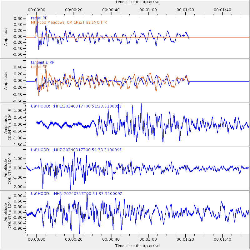
HOOD Mt Hood Meadows, OR CREST BB SMO - Earthquake Result Viewer
*The percent match for this event was below the threshold and hence no stack was calculated.
| Earthquake location: |
Near Coast Of Nicaragua |
| Earthquake latitude/longitude: |
12.4/-87.7 |
| Earthquake time(UTC): |
2024/03/17 (077) 00:44:03 GMT |
| Earthquake Depth: |
53 km |
| Earthquake Magnitude: |
5.6 mww |
| Earthquake Catalog/Contributor: |
NEIC PDE/us |
|
| Network: |
UW Pacific Northwest Regional Seismic Network |
| Station: |
HOOD Mt Hood Meadows, OR CREST BB SMO |
| Lat/Lon: |
45.32 N/121.65 W |
| Elevation: |
1520 m |
|
| Distance: |
43.8 deg |
| Az: |
325.245 deg |
| Baz: |
127.856 deg |
| Ray Param: |
$rayparam |
*The percent match for this event was below the threshold and hence was not used in the summary stack. |
|
| Radial Match: |
64.0544 % |
| Radial Bump: |
400 |
| Transverse Match: |
71.82199 % |
| Transverse Bump: |
400 |
| SOD ConfigId: |
33437571 |
| Insert Time: |
2024-03-31 01:03:44.308 +0000 |
| GWidth: |
2.5 |
| Max Bumps: |
400 |
| Tol: |
0.001 |
|
Signal To Noise
| Channel | StoN | STA | LTA |
| UW:HOOD: :HHZ:20240317T00:51:33.310009Z | 4.236472 | 6.180743E-7 | 1.4589364E-7 |
| UW:HOOD: :HHN:20240317T00:51:33.310009Z | 1.0446293 | 2.569762E-7 | 2.4599748E-7 |
| UW:HOOD: :HHE:20240317T00:51:33.310009Z | 2.7119026 | 3.313527E-7 | 1.2218459E-7 |
| Arrivals |
| Ps | |
| PpPs | |
| PsPs/PpSs | |


