M04C Macdoel, CA, USA - Earthquake Result Viewer
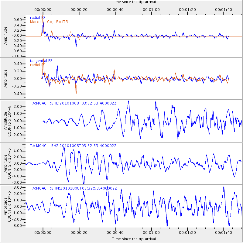
Earthquake location: Andreanof Islands, Aleutian Is.
Earthquake latitude/longitude: 51.4/-175.4
Earthquake time(UTC): 2010/10/08 (281) 03:26:13 GMT
Earthquake Depth: 19 km
Earthquake Magnitude: 6.2 MB, 6.3 MS, 6.4 MW, 6.2 MW
Earthquake Catalog/Contributor: WHDF/NEIC
Network: TA USArray Transportable Network (new EarthScope stations)
Station: M04C Macdoel, CA, USA
Lat/Lon: 41.78 N/121.84 W
Elevation: 1391 m
Distance: 37.3 deg
Az: 83.397 deg
Baz: 303.642 deg
Ray Param: 0.076212816
Estimated Moho Depth: 33.5 km
Estimated Crust Vp/Vs: 1.89
Assumed Crust Vp: 6.566 km/s
Estimated Crust Vs: 3.47 km/s
Estimated Crust Poisson's Ratio: 0.31
Radial Match: 80.01296 %
Radial Bump: 400
Transverse Match: 72.85547 %
Transverse Bump: 400
SOD ConfigId: 339645
Insert Time: 2011-02-10 07:53:38.769 +0000
GWidth: 2.5
Max Bumps: 400
Tol: 0.001

Signal To Noise

ChannelStoNSTALTA
TA:M04C: :BHZ:20101008T03:32:53.400002Z2.47906166.5677335E-72.6492822E-7
TA:M04C: :BHN:20101008T03:32:53.400002Z1.8278897.271372E-73.978016E-7
TA:M04C: :BHE:20101008T03:32:53.400002Z2.63937769.645744E-73.6545526E-7
Arrivals
Ps4.9 SECOND
PpPs14 SECOND
PsPs/PpSs19 SECOND