T25A Trinidad, CO, USA - Earthquake Result Viewer
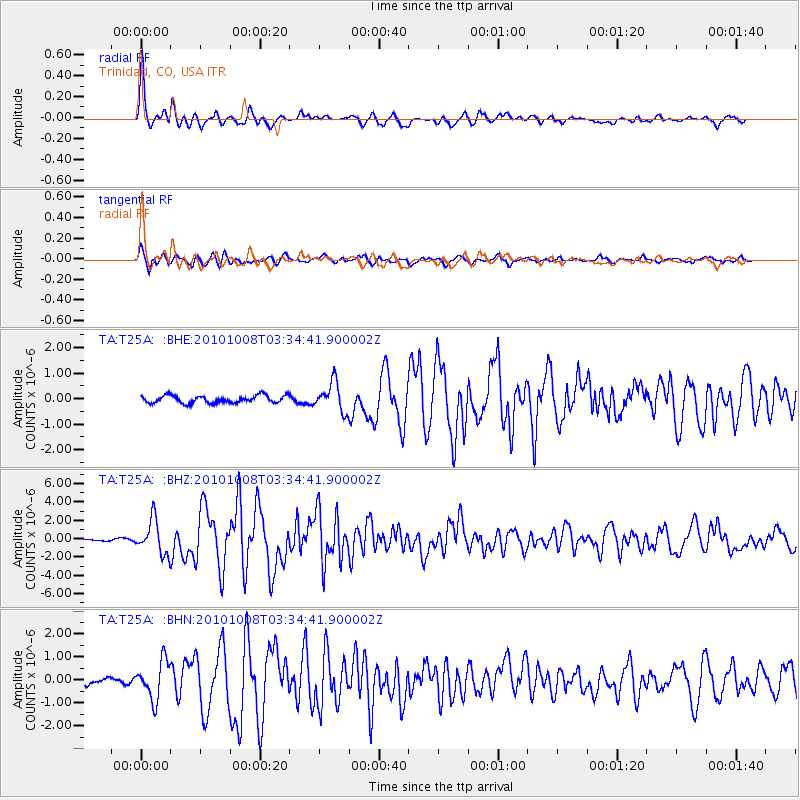
Earthquake location: Andreanof Islands, Aleutian Is.
Earthquake latitude/longitude: 51.4/-175.4
Earthquake time(UTC): 2010/10/08 (281) 03:26:13 GMT
Earthquake Depth: 19 km
Earthquake Magnitude: 6.2 MB, 6.3 MS, 6.4 MW, 6.2 MW
Earthquake Catalog/Contributor: WHDF/NEIC
Network: TA USArray Transportable Network (new EarthScope stations)
Station: T25A Trinidad, CO, USA
Lat/Lon: 37.14 N/104.41 W
Elevation: 2017 m
Distance: 50.8 deg
Az: 77.058 deg
Baz: 310.144 deg
Ray Param: 0.06778513
Estimated Moho Depth: 33.0 km
Estimated Crust Vp/Vs: 1.96
Assumed Crust Vp: 6.316 km/s
Estimated Crust Vs: 3.226 km/s
Estimated Crust Poisson's Ratio: 0.32
Radial Match: 92.99064 %
Radial Bump: 400
Transverse Match: 88.55318 %
Transverse Bump: 400
SOD ConfigId: 339645
Insert Time: 2011-02-10 07:54:17.694 +0000
GWidth: 2.5
Max Bumps: 400
Tol: 0.001

Signal To Noise

ChannelStoNSTALTA
TA:T25A: :BHZ:20101008T03:34:41.900002Z13.5360871.8256163E-61.348703E-7
TA:T25A: :BHN:20101008T03:34:41.900002Z4.7332218.2054305E-71.7335829E-7
TA:T25A: :BHE:20101008T03:34:41.900002Z3.81068135.5818356E-71.4647867E-7
Arrivals
Ps5.3 SECOND
PpPs15 SECOND
PsPs/PpSs20 SECOND