MDND Maddock, ND, USA - Earthquake Result Viewer
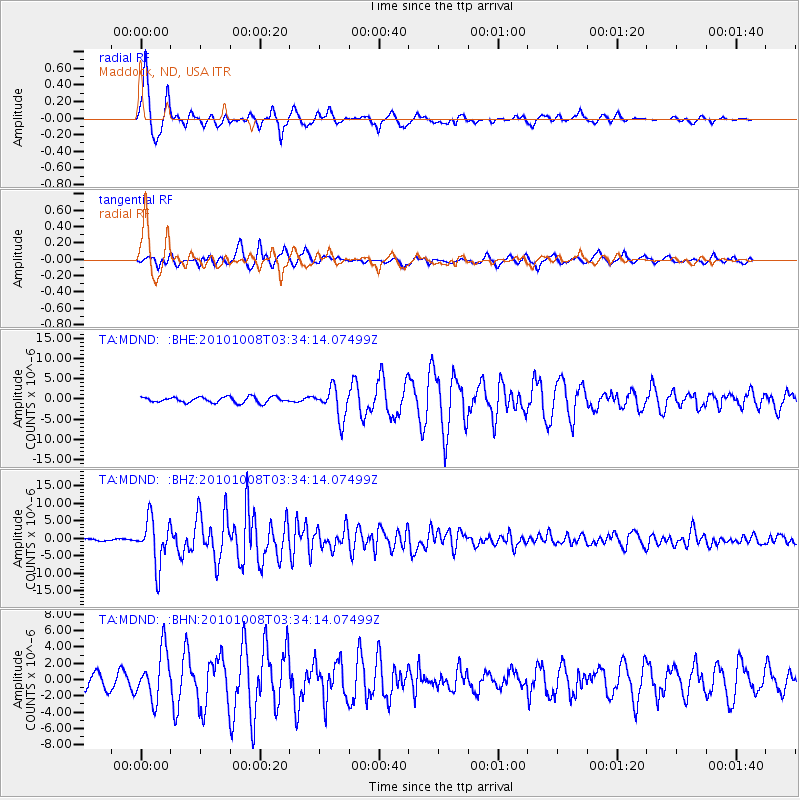
Earthquake location: Andreanof Islands, Aleutian Is.
Earthquake latitude/longitude: 51.4/-175.4
Earthquake time(UTC): 2010/10/08 (281) 03:26:13 GMT
Earthquake Depth: 19 km
Earthquake Magnitude: 6.2 MB, 6.3 MS, 6.4 MW, 6.2 MW
Earthquake Catalog/Contributor: WHDF/NEIC
Network: TA USArray Transportable Network (new EarthScope stations)
Station: MDND Maddock, ND, USA
Lat/Lon: 47.85 N/99.60 W
Elevation: 479 m
Distance: 47.2 deg
Az: 62.896 deg
Baz: 304.07 deg
Ray Param: 0.07014178
Estimated Moho Depth: 26.5 km
Estimated Crust Vp/Vs: 2.06
Assumed Crust Vp: 6.53 km/s
Estimated Crust Vs: 3.17 km/s
Estimated Crust Poisson's Ratio: 0.35
Radial Match: 95.478264 %
Radial Bump: 348
Transverse Match: 88.165764 %
Transverse Bump: 400
SOD ConfigId: 339645
Insert Time: 2011-02-10 07:54:34.781 +0000
GWidth: 2.5
Max Bumps: 400
Tol: 0.001

Signal To Noise

ChannelStoNSTALTA
TA:MDND: :BHZ:20101008T03:34:14.07499Z28.0449096.534404E-62.3299788E-7
TA:MDND: :BHN:20101008T03:34:14.07499Z4.93969442.9816802E-66.036163E-7
TA:MDND: :BHE:20101008T03:34:14.07499Z5.31440973.744871E-67.046636E-7
Arrivals
Ps4.5 SECOND
PpPs12 SECOND
PsPs/PpSs16 SECOND