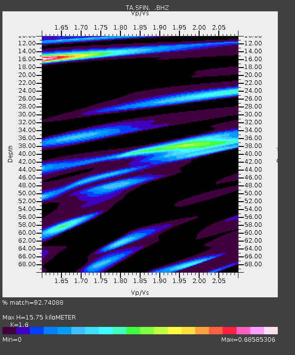
SFIN Lafayette, IN, USA - Earthquake Result Viewer

Earthquake location: Andreanof Islands, Aleutian Is.
Earthquake latitude/longitude: 51.4/-175.4
Earthquake time(UTC): 2010/10/08 (281) 03:26:13 GMT
Earthquake Depth: 19 km
Earthquake Magnitude: 6.2 MB, 6.3 MS, 6.4 MW, 6.2 MW
Earthquake Catalog/Contributor: WHDF/NEIC
Network: TA USArray Transportable Network (new EarthScope stations)
Station: SFIN Lafayette, IN, USA
Lat/Lon: 40.38 N/87.10 W
Elevation: 165 m
Distance: 58.8 deg
Az: 63.156 deg
Baz: 312.939 deg
Ray Param: 0.062557064
Estimated Moho Depth: 15.75 km
Estimated Crust Vp/Vs: 1.60
Assumed Crust Vp: 6.498 km/s
Estimated Crust Vs: 4.061 km/s
Estimated Crust Poisson's Ratio: 0.18
Radial Match: 92.74088 %
Radial Bump: 289
Transverse Match: 75.650055 %
Transverse Bump: 400
SOD ConfigId: 339645
Insert Time: 2011-02-10 07:54:42.937 +0000
GWidth: 2.5
Max Bumps: 400
Tol: 0.001

Signal To Noise

ChannelStoNSTALTA
TA:SFIN: :BHZ:20101008T03:35:39.975015Z8.3038644.61013E-65.5517893E-7
TA:SFIN: :BHN:20101008T03:35:39.975015Z3.39538071.3798838E-64.064003E-7
TA:SFIN: :BHE:20101008T03:35:39.975015Z5.75798941.4179227E-62.462531E-7
Arrivals
Ps1.5 SECOND
PpPs6.0 SECOND
PsPs/PpSs7.5 SECOND