BGNE Belgrade, NE, USA - Earthquake Result Viewer
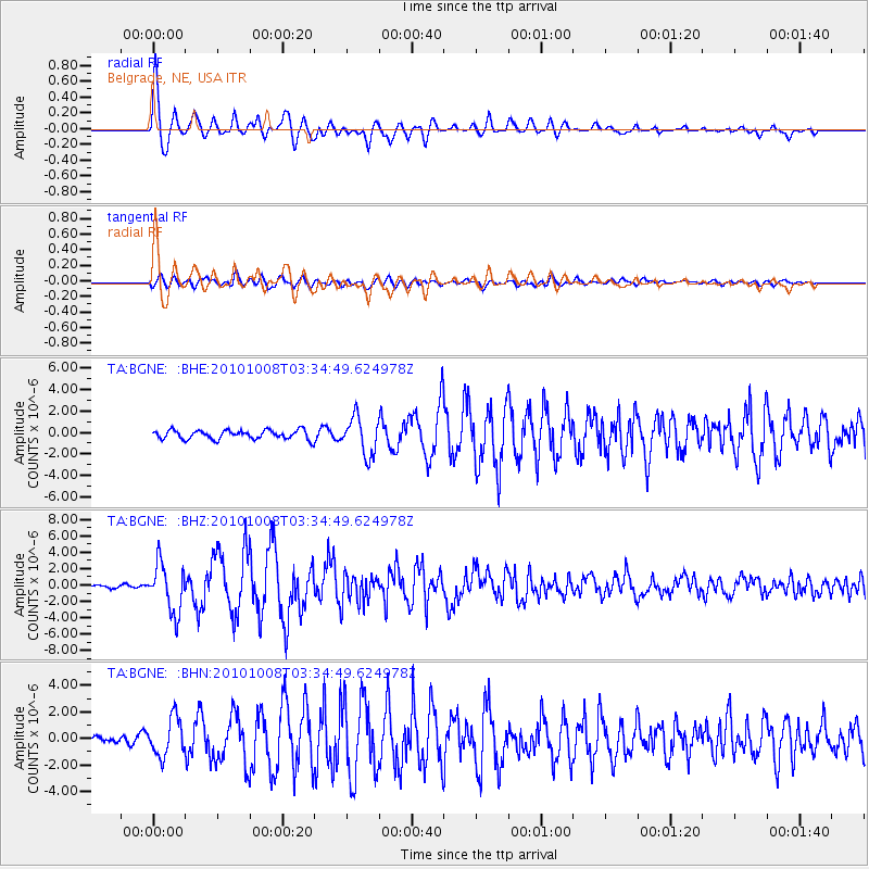
Earthquake location: Andreanof Islands, Aleutian Is.
Earthquake latitude/longitude: 51.4/-175.4
Earthquake time(UTC): 2010/10/08 (281) 03:26:13 GMT
Earthquake Depth: 19 km
Earthquake Magnitude: 6.2 MB, 6.3 MS, 6.4 MW, 6.2 MW
Earthquake Catalog/Contributor: WHDF/NEIC
Network: TA USArray Transportable Network (new EarthScope stations)
Station: BGNE Belgrade, NE, USA
Lat/Lon: 41.41 N/98.15 W
Elevation: 573 m
Distance: 51.8 deg
Az: 68.886 deg
Baz: 308.984 deg
Ray Param: 0.06712307
Estimated Moho Depth: 36.0 km
Estimated Crust Vp/Vs: 2.05
Assumed Crust Vp: 6.53 km/s
Estimated Crust Vs: 3.189 km/s
Estimated Crust Poisson's Ratio: 0.34
Radial Match: 95.71907 %
Radial Bump: 400
Transverse Match: 79.33146 %
Transverse Bump: 400
SOD ConfigId: 339645
Insert Time: 2011-02-10 07:55:00.447 +0000
GWidth: 2.5
Max Bumps: 400
Tol: 0.001

Signal To Noise

ChannelStoNSTALTA
TA:BGNE: :BHZ:20101008T03:34:49.624978Z15.451232.959854E-61.9156107E-7
TA:BGNE: :BHN:20101008T03:34:49.624978Z4.4431331.4300165E-63.218487E-7
TA:BGNE: :BHE:20101008T03:34:49.624978Z4.18506961.7465809E-64.1733617E-7
Arrivals
Ps6.1 SECOND
PpPs16 SECOND
PsPs/PpSs22 SECOND