R26A Arlington, CO, USA - Earthquake Result Viewer
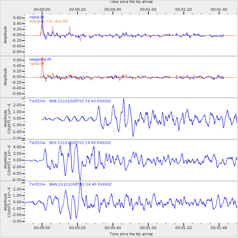
Earthquake location: Andreanof Islands, Aleutian Is.
Earthquake latitude/longitude: 51.4/-175.4
Earthquake time(UTC): 2010/10/08 (281) 03:26:13 GMT
Earthquake Depth: 19 km
Earthquake Magnitude: 6.2 MB, 6.3 MS, 6.4 MW, 6.2 MW
Earthquake Catalog/Contributor: WHDF/NEIC
Network: TA USArray Transportable Network (new EarthScope stations)
Station: R26A Arlington, CO, USA
Lat/Lon: 38.30 N/103.45 W
Elevation: 1304 m
Distance: 50.7 deg
Az: 75.275 deg
Baz: 309.602 deg
Ray Param: 0.06788916
Estimated Moho Depth: 55.5 km
Estimated Crust Vp/Vs: 1.66
Assumed Crust Vp: 6.242 km/s
Estimated Crust Vs: 3.76 km/s
Estimated Crust Poisson's Ratio: 0.22
Radial Match: 94.19317 %
Radial Bump: 400
Transverse Match: 77.23561 %
Transverse Bump: 400
SOD ConfigId: 339645
Insert Time: 2011-02-10 07:55:22.473 +0000
GWidth: 2.5
Max Bumps: 400
Tol: 0.001

Signal To Noise

ChannelStoNSTALTA
TA:R26A: :BHZ:20101008T03:34:40.69999Z11.5077481.8074936E-61.5706753E-7
TA:R26A: :BHN:20101008T03:34:40.69999Z4.83716776.859043E-71.4179874E-7
TA:R26A: :BHE:20101008T03:34:40.69999Z4.74052679.764717E-72.059838E-7
Arrivals
Ps6.2 SECOND
PpPs22 SECOND
PsPs/PpSs29 SECOND