
T28A Walsh, CO, USA - Earthquake Result Viewer
| ||||||||||||||||||
| ||||||||||||||||||
| ||||||||||||||||||
|
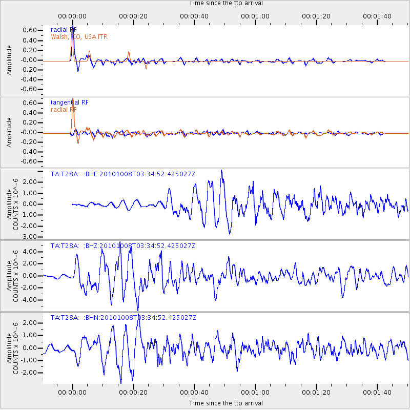
Signal To Noise
| Channel | StoN | STA | LTA |
| TA:T28A: :BHZ:20101008T03:34:52.425027Z | 9.520484 | 1.9114364E-6 | 2.0077091E-7 |
| TA:T28A: :BHN:20101008T03:34:52.425027Z | 3.2897027 | 7.347103E-7 | 2.2333639E-7 |
| TA:T28A: :BHE:20101008T03:34:52.425027Z | 3.5984359 | 7.370626E-7 | 2.048286E-7 |
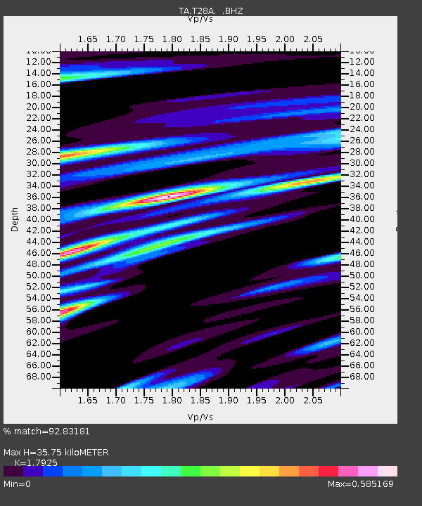
| Arrivals | |
| Ps | 4.7 SECOND |
| PpPs | 15 SECOND |
| PsPs/PpSs | 20 SECOND |

