You are here: Home > Network List > TA - USArray Transportable Network (new EarthScope stations) Stations List
> Station U30A WK&E Inc., Balko, OK, USA > Earthquake Result Viewer
U30A WK&E Inc., Balko, OK, USA - Earthquake Result Viewer

| Earthquake location: |
Andreanof Islands, Aleutian Is. |
| Earthquake latitude/longitude: |
51.4/-175.4 |
| Earthquake time(UTC): |
2010/10/08 (281) 03:26:13 GMT |
| Earthquake Depth: |
19 km |
| Earthquake Magnitude: |
6.2 MB, 6.3 MS, 6.4 MW, 6.2 MW |
| Earthquake Catalog/Contributor: |
WHDF/NEIC |
|
| Network: |
TA USArray Transportable Network (new EarthScope stations) |
| Station: |
U30A WK&E Inc., Balko, OK, USA |
| Lat/Lon: |
36.53 N/100.65 W |
| Elevation: |
881 m |
|
| Distance: |
53.5 deg |
| Az: |
75.151 deg |
| Baz: |
311.218 deg |
| Ray Param: |
0.066040866 |
| Estimated Moho Depth: |
14.5 km |
| Estimated Crust Vp/Vs: |
2.10 |
| Assumed Crust Vp: |
6.483 km/s |
| Estimated Crust Vs: |
3.091 km/s |
| Estimated Crust Poisson's Ratio: |
0.35 |
|
| Radial Match: |
92.33529 % |
| Radial Bump: |
400 |
| Transverse Match: |
85.89968 % |
| Transverse Bump: |
400 |
| SOD ConfigId: |
339645 |
| Insert Time: |
2011-02-10 07:57:19.351 +0000 |
| GWidth: |
2.5 |
| Max Bumps: |
400 |
| Tol: |
0.001 |
|
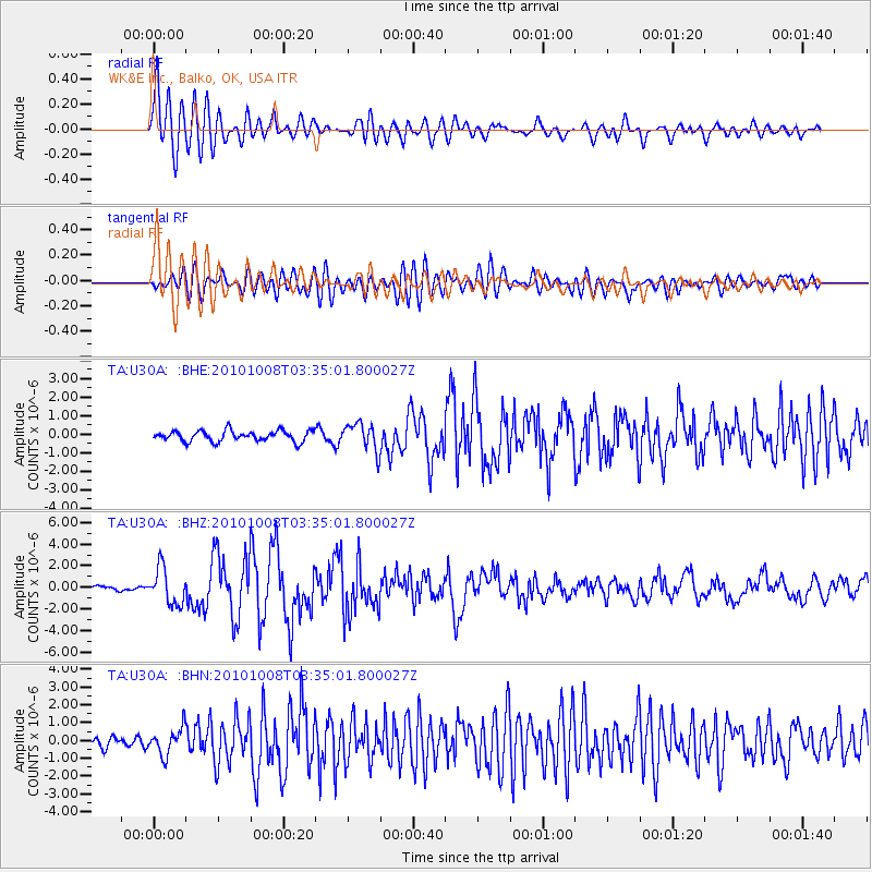
Signal To Noise
| Channel | StoN | STA | LTA |
| TA:U30A: :BHZ:20101008T03:35:01.800027Z | 5.7990723 | 1.6669026E-6 | 2.8744296E-7 |
| TA:U30A: :BHN:20101008T03:35:01.800027Z | 2.7308612 | 7.4601223E-7 | 2.731784E-7 |
| TA:U30A: :BHE:20101008T03:35:01.800027Z | 2.579173 | 7.394772E-7 | 2.8671096E-7 |
| Arrivals |
| Ps | 2.6 SECOND |
| PpPs | 6.6 SECOND |
| PsPs/PpSs | 9.2 SECOND |


