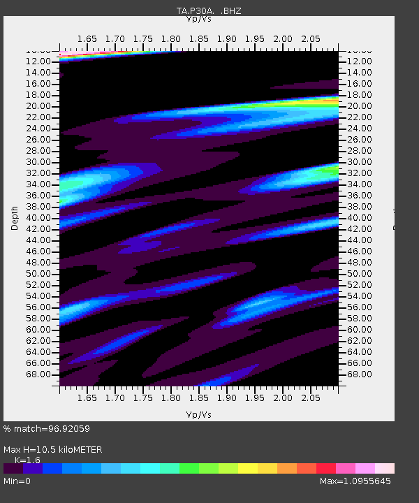
P30A Selden, KS, USA - Earthquake Result Viewer
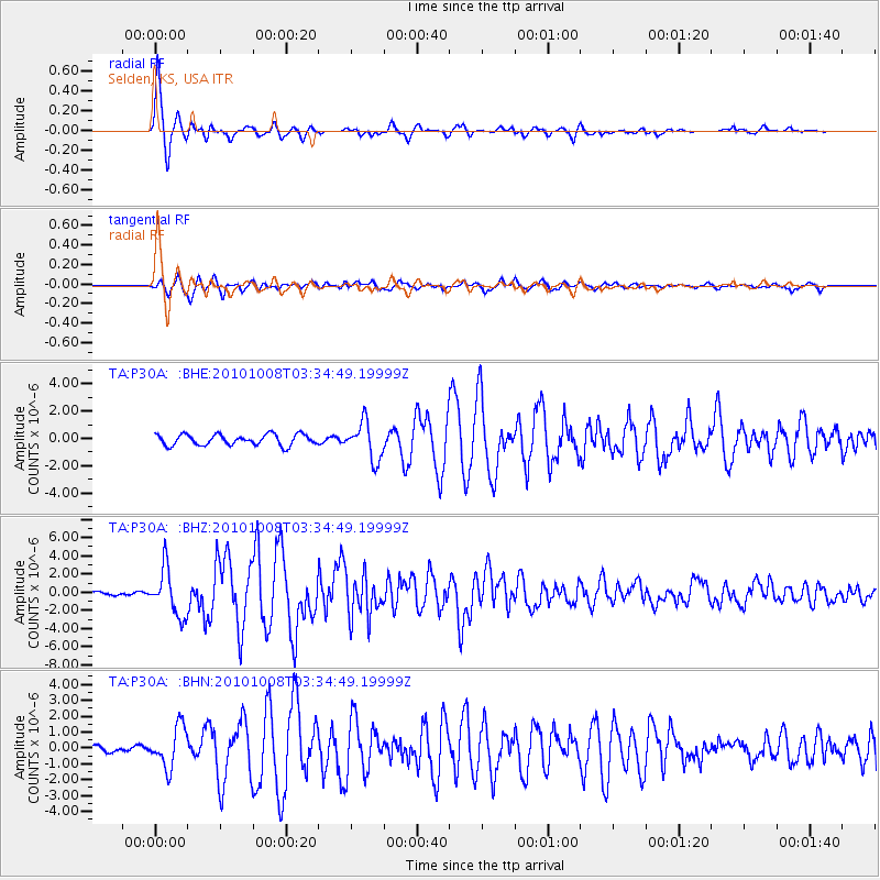
Earthquake location: Andreanof Islands, Aleutian Is.
Earthquake latitude/longitude: 51.4/-175.4
Earthquake time(UTC): 2010/10/08 (281) 03:26:13 GMT
Earthquake Depth: 19 km
Earthquake Magnitude: 6.2 MB, 6.3 MS, 6.4 MW, 6.2 MW
Earthquake Catalog/Contributor: WHDF/NEIC
Network: TA USArray Transportable Network (new EarthScope stations)
Station: P30A Selden, KS, USA
Lat/Lon: 39.54 N/100.25 W
Elevation: 788 m
Distance: 51.8 deg
Az: 72.008 deg
Baz: 309.558 deg
Ray Param: 0.06716272
Estimated Moho Depth: 10.5 km
Estimated Crust Vp/Vs: 1.60
Assumed Crust Vp: 6.483 km/s
Estimated Crust Vs: 4.052 km/s
Estimated Crust Poisson's Ratio: 0.18
Radial Match: 96.92059 %
Radial Bump: 342
Transverse Match: 90.17319 %
Transverse Bump: 400
SOD ConfigId: 339645
Insert Time: 2011-02-10 07:58:57.743 +0000
GWidth: 2.5
Max Bumps: 400
Tol: 0.001

Signal To Noise

ChannelStoNSTALTA
TA:P30A: :BHZ:20101008T03:34:49.19999Z13.6459532.5727188E-61.8853348E-7
TA:P30A: :BHN:20101008T03:34:49.19999Z5.55598741.2773467E-62.2990453E-7
TA:P30A: :BHE:20101008T03:34:49.19999Z3.46535351.3627231E-63.9324217E-7
Arrivals
Ps1.0 SECOND
PpPs4.0 SECOND
PsPs/PpSs5.0 SECOND