I28A Midland, SD, USA - Earthquake Result Viewer
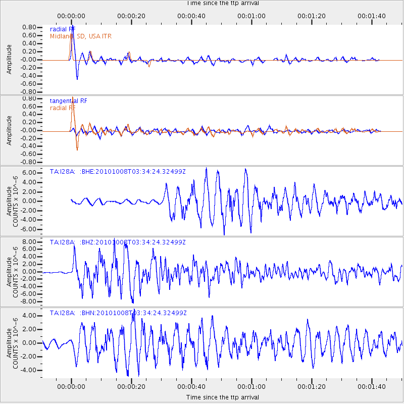
Earthquake location: Andreanof Islands, Aleutian Is.
Earthquake latitude/longitude: 51.4/-175.4
Earthquake time(UTC): 2010/10/08 (281) 03:26:13 GMT
Earthquake Depth: 19 km
Earthquake Magnitude: 6.2 MB, 6.3 MS, 6.4 MW, 6.2 MW
Earthquake Catalog/Contributor: WHDF/NEIC
Network: TA USArray Transportable Network (new EarthScope stations)
Station: I28A Midland, SD, USA
Lat/Lon: 44.00 N/101.17 W
Elevation: 655 m
Distance: 48.5 deg
Az: 67.989 deg
Baz: 306.368 deg
Ray Param: 0.06929622
Estimated Moho Depth: 11.0 km
Estimated Crust Vp/Vs: 1.60
Assumed Crust Vp: 6.483 km/s
Estimated Crust Vs: 4.052 km/s
Estimated Crust Poisson's Ratio: 0.18
Radial Match: 95.0044 %
Radial Bump: 319
Transverse Match: 90.98393 %
Transverse Bump: 400
SOD ConfigId: 339645
Insert Time: 2011-02-10 08:01:01.083 +0000
GWidth: 2.5
Max Bumps: 400
Tol: 0.001

Signal To Noise

ChannelStoNSTALTA
TA:I28A: :BHZ:20101008T03:34:24.32499Z20.5354963.1493848E-61.5336299E-7
TA:I28A: :BHN:20101008T03:34:24.32499Z3.77096961.8112843E-64.803232E-7
TA:I28A: :BHE:20101008T03:34:24.32499Z5.9024842.2105557E-63.7451278E-7
Arrivals
Ps1.1 SECOND
PpPs4.1 SECOND
PsPs/PpSs5.2 SECOND