H26A Fairpoint, SD, USA - Earthquake Result Viewer
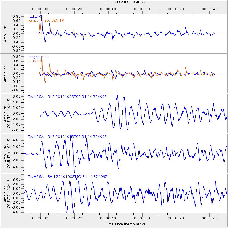
Earthquake location: Andreanof Islands, Aleutian Is.
Earthquake latitude/longitude: 51.4/-175.4
Earthquake time(UTC): 2010/10/08 (281) 03:26:13 GMT
Earthquake Depth: 19 km
Earthquake Magnitude: 6.2 MB, 6.3 MS, 6.4 MW, 6.2 MW
Earthquake Catalog/Contributor: WHDF/NEIC
Network: TA USArray Transportable Network (new EarthScope stations)
Station: H26A Fairpoint, SD, USA
Lat/Lon: 44.62 N/102.77 W
Elevation: 879 m
Distance: 47.2 deg
Az: 68.226 deg
Baz: 305.41 deg
Ray Param: 0.07012021
Estimated Moho Depth: 32.25 km
Estimated Crust Vp/Vs: 2.07
Assumed Crust Vp: 6.242 km/s
Estimated Crust Vs: 3.023 km/s
Estimated Crust Poisson's Ratio: 0.35
Radial Match: 92.517006 %
Radial Bump: 337
Transverse Match: 75.76489 %
Transverse Bump: 400
SOD ConfigId: 339645
Insert Time: 2011-02-10 08:01:20.216 +0000
GWidth: 2.5
Max Bumps: 400
Tol: 0.001

Signal To Noise

ChannelStoNSTALTA
TA:H26A: :BHZ:20101008T03:34:14.32499Z17.7282312.4264316E-61.3686822E-7
TA:H26A: :BHN:20101008T03:34:14.32499Z1.5247531.0197019E-66.687653E-7
TA:H26A: :BHE:20101008T03:34:14.32499Z2.4356081.5187933E-66.235787E-7
Arrivals
Ps5.8 SECOND
PpPs15 SECOND
PsPs/PpSs21 SECOND