
E30A Jud, ND, USA - Earthquake Result Viewer
| ||||||||||||||||||
| ||||||||||||||||||
| ||||||||||||||||||
|
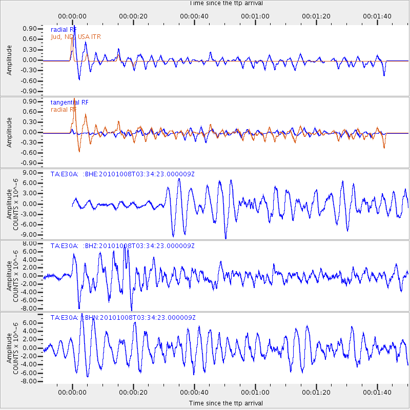
Signal To Noise
| Channel | StoN | STA | LTA |
| TA:E30A: :BHZ:20101008T03:34:23.000009Z | 13.578947 | 3.5858932E-6 | 2.640774E-7 |
| TA:E30A: :BHN:20101008T03:34:23.000009Z | 6.957089 | 4.229597E-6 | 6.07955E-7 |
| TA:E30A: :BHE:20101008T03:34:23.000009Z | 6.576742 | 4.3552805E-6 | 6.6222464E-7 |
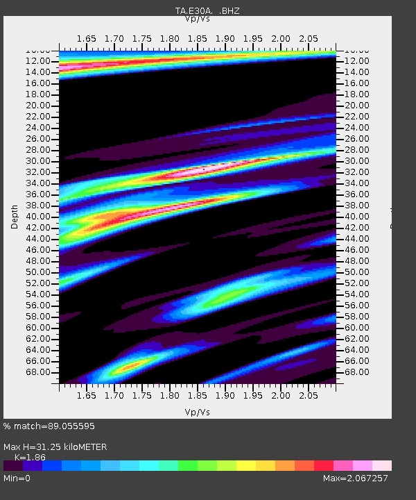
| Arrivals | |
| Ps | 4.4 SECOND |
| PpPs | 13 SECOND |
| PsPs/PpSs | 17 SECOND |

