
F30A Leola, SD, USA - Earthquake Result Viewer
| ||||||||||||||||||
| ||||||||||||||||||
| ||||||||||||||||||
|
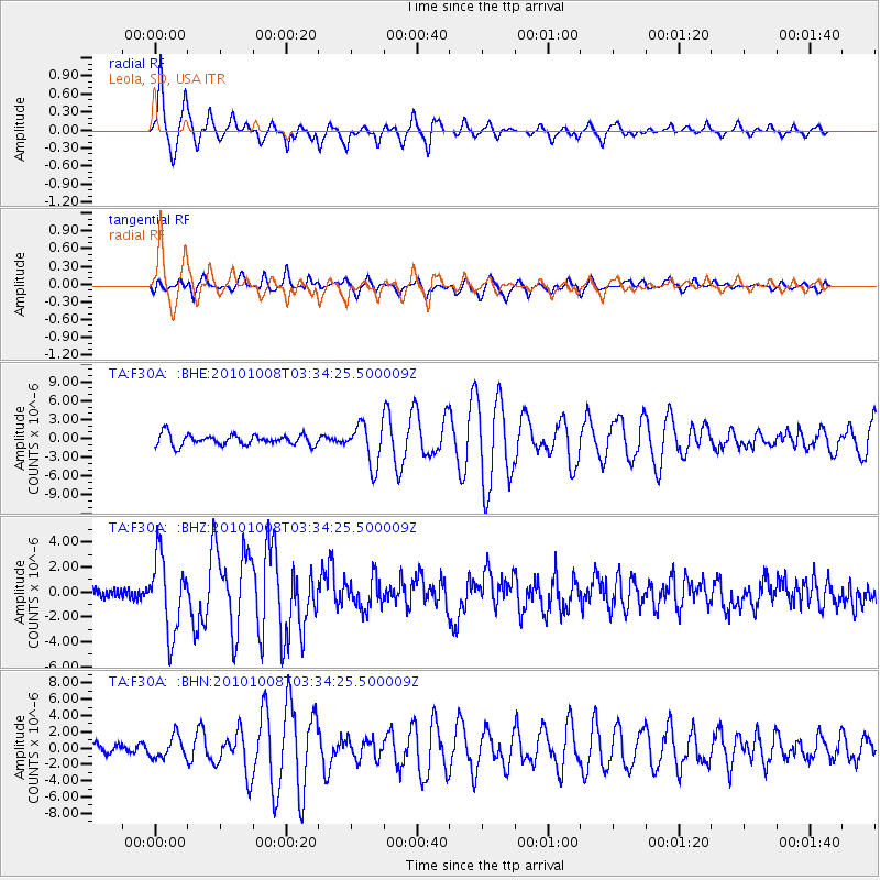
Signal To Noise
| Channel | StoN | STA | LTA |
| TA:F30A: :BHZ:20101008T03:34:25.500009Z | 9.226556 | 3.00843E-6 | 3.260621E-7 |
| TA:F30A: :BHN:20101008T03:34:25.500009Z | 1.1686127 | 1.3192537E-6 | 1.1289059E-6 |
| TA:F30A: :BHE:20101008T03:34:25.500009Z | 3.7675016 | 3.2513449E-6 | 8.6299764E-7 |
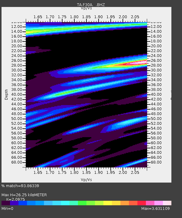
| Arrivals | |
| Ps | 4.6 SECOND |
| PpPs | 12 SECOND |
| PsPs/PpSs | 16 SECOND |

