
G29A Hoven, SD, USA - Earthquake Result Viewer
| ||||||||||||||||||
| ||||||||||||||||||
| ||||||||||||||||||
|
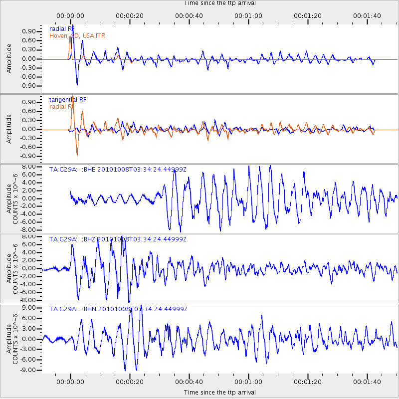
Signal To Noise
| Channel | StoN | STA | LTA |
| TA:G29A: :BHZ:20101008T03:34:24.44999Z | 20.669647 | 3.6668337E-6 | 1.7740184E-7 |
| TA:G29A: :BHN:20101008T03:34:24.44999Z | 2.9169183 | 2.4229587E-6 | 8.306571E-7 |
| TA:G29A: :BHE:20101008T03:34:24.44999Z | 4.9574885 | 3.7243155E-6 | 7.512504E-7 |
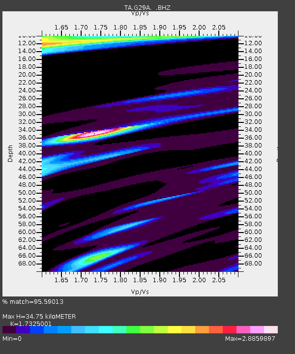
| Arrivals | |
| Ps | 4.2 SECOND |
| PpPs | 14 SECOND |
| PsPs/PpSs | 18 SECOND |

