H29A Onida, SD, USA - Earthquake Result Viewer
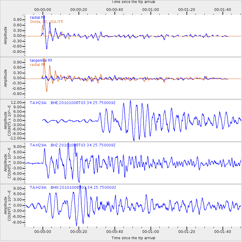
Earthquake location: Andreanof Islands, Aleutian Is.
Earthquake latitude/longitude: 51.4/-175.4
Earthquake time(UTC): 2010/10/08 (281) 03:26:13 GMT
Earthquake Depth: 19 km
Earthquake Magnitude: 6.2 MB, 6.3 MS, 6.4 MW, 6.2 MW
Earthquake Catalog/Contributor: WHDF/NEIC
Network: TA USArray Transportable Network (new EarthScope stations)
Station: H29A Onida, SD, USA
Lat/Lon: 44.63 N/100.21 W
Elevation: 548 m
Distance: 48.7 deg
Az: 66.774 deg
Baz: 306.231 deg
Ray Param: 0.06917405
Estimated Moho Depth: 12.25 km
Estimated Crust Vp/Vs: 1.60
Assumed Crust Vp: 6.53 km/s
Estimated Crust Vs: 4.082 km/s
Estimated Crust Poisson's Ratio: 0.18
Radial Match: 98.673294 %
Radial Bump: 281
Transverse Match: 91.11983 %
Transverse Bump: 400
SOD ConfigId: 339645
Insert Time: 2011-02-10 08:04:38.053 +0000
GWidth: 2.5
Max Bumps: 400
Tol: 0.001

Signal To Noise

ChannelStoNSTALTA
TA:H29A: :BHZ:20101008T03:34:25.750009Z20.3763244.1928506E-62.0577072E-7
TA:H29A: :BHN:20101008T03:34:25.750009Z7.24398143.0255185E-64.1765963E-7
TA:H29A: :BHE:20101008T03:34:25.750009Z6.73666953.854627E-65.7218585E-7
Arrivals
Ps1.2 SECOND
PpPs4.6 SECOND
PsPs/PpSs5.8 SECOND