K30A Basset, NE, USA - Earthquake Result Viewer
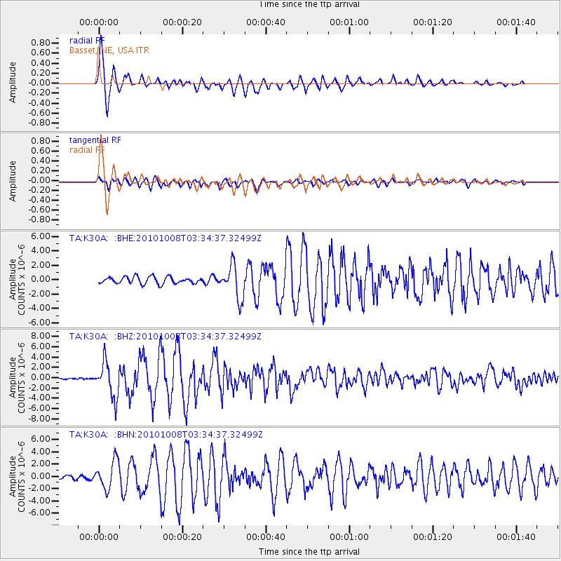
Earthquake location: Andreanof Islands, Aleutian Is.
Earthquake latitude/longitude: 51.4/-175.4
Earthquake time(UTC): 2010/10/08 (281) 03:26:13 GMT
Earthquake Depth: 19 km
Earthquake Magnitude: 6.2 MB, 6.3 MS, 6.4 MW, 6.2 MW
Earthquake Catalog/Contributor: WHDF/NEIC
Network: TA USArray Transportable Network (new EarthScope stations)
Station: K30A Basset, NE, USA
Lat/Lon: 42.67 N/99.61 W
Elevation: 712 m
Distance: 50.2 deg
Az: 68.48 deg
Baz: 307.753 deg
Ray Param: 0.06818952
Estimated Moho Depth: 10.5 km
Estimated Crust Vp/Vs: 1.61
Assumed Crust Vp: 6.53 km/s
Estimated Crust Vs: 4.056 km/s
Estimated Crust Poisson's Ratio: 0.19
Radial Match: 96.107254 %
Radial Bump: 399
Transverse Match: 87.082985 %
Transverse Bump: 400
SOD ConfigId: 339645
Insert Time: 2011-02-10 08:05:17.345 +0000
GWidth: 2.5
Max Bumps: 400
Tol: 0.001

Signal To Noise

ChannelStoNSTALTA
TA:K30A: :BHZ:20101008T03:34:37.32499Z13.4621013.4588004E-62.5692873E-7
TA:K30A: :BHN:20101008T03:34:37.32499Z5.31462572.3484833E-64.4189062E-7
TA:K30A: :BHE:20101008T03:34:37.32499Z5.1205272.377996E-64.6440454E-7
Arrivals
Ps1.0 SECOND
PpPs3.9 SECOND
PsPs/PpSs5.0 SECOND