
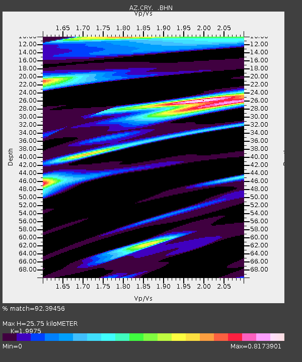
CRY AZ.CRY - Earthquake Result Viewer
| ||||||||||||||||||
| ||||||||||||||||||
| ||||||||||||||||||
|
Signal To Noise
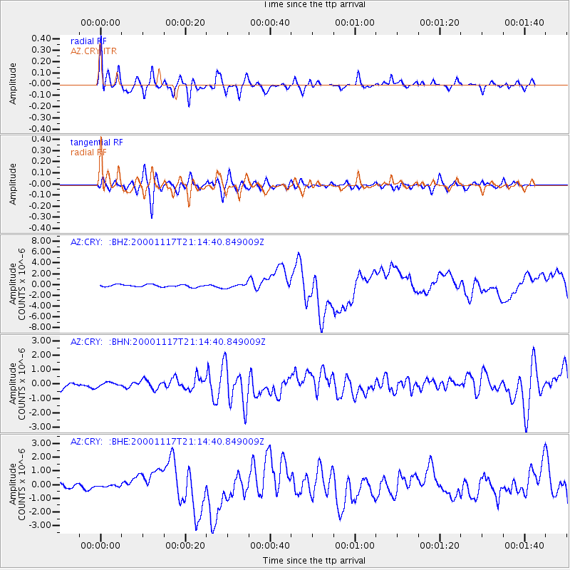
| Channel | StoN | STA | LTA |
| AZ:CRY: :BHN:20001117T21:14:40.849009Z | 0.55359066 | 1.7514859E-7 | 3.1638646E-7 |
| AZ:CRY: :BHE:20001117T21:14:40.849009Z | 0.35261008 | 5.118208E-8 | 1.4515207E-7 |
| AZ:CRY: :BHZ:20001117T21:14:40.849009Z | 1.8294954 | 3.8797052E-7 | 2.1206422E-7 |
| Arrivals | |
| Ps | 4.2 SECOND |
| PpPs | 12 SECOND |
| PsPs/PpSs | 16 SECOND |

