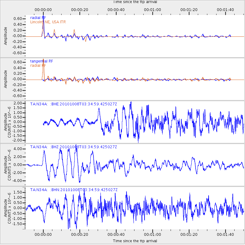
N34A Lincoln, NE, USA - Earthquake Result Viewer
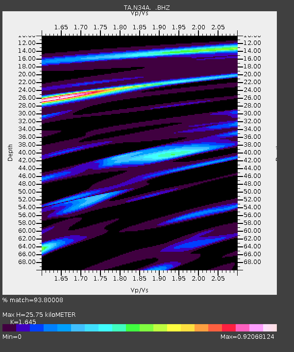
Earthquake location: Andreanof Islands, Aleutian Is.
Earthquake latitude/longitude: 51.4/-175.4
Earthquake time(UTC): 2010/10/08 (281) 03:26:13 GMT
Earthquake Depth: 19 km
Earthquake Magnitude: 6.2 MB, 6.3 MS, 6.4 MW, 6.2 MW
Earthquake Catalog/Contributor: WHDF/NEIC
Network: TA USArray Transportable Network (new EarthScope stations)
Station: N34A Lincoln, NE, USA
Lat/Lon: 40.84 N/96.50 W
Elevation: 401 m
Distance: 53.2 deg
Az: 68.444 deg
Baz: 309.796 deg
Ray Param: 0.06625706
Estimated Moho Depth: 25.75 km
Estimated Crust Vp/Vs: 1.64
Assumed Crust Vp: 6.498 km/s
Estimated Crust Vs: 3.95 km/s
Estimated Crust Poisson's Ratio: 0.21
Radial Match: 93.80008 %
Radial Bump: 314
Transverse Match: 72.301056 %
Transverse Bump: 400
SOD ConfigId: 339645
Insert Time: 2011-02-10 08:08:31.388 +0000
GWidth: 2.5
Max Bumps: 400
Tol: 0.001

Signal To Noise

ChannelStoNSTALTA
TA:N34A: :BHZ:20101008T03:34:59.425027Z12.0638922.13303E-61.768111E-7
TA:N34A: :BHN:20101008T03:34:59.425027Z3.35754256.158317E-71.834174E-7
TA:N34A: :BHE:20101008T03:34:59.425027Z3.45427358.051358E-72.3308397E-7
Arrivals
Ps2.7 SECOND
PpPs9.9 SECOND
PsPs/PpSs13 SECOND